

420
13.4.4 Mariout Lake
13.4.4.1 Site Description
Lake Mariout is situated along the Mediterranean coast of Egypt south of Alexandria
city (long. 29°51′ 00″–29° 56′ 15″E, lat. 31°04′ 15″–31° 10′ 45″ N) as shown in
Fig. 13.5. It has been divided artificially by international roads and railway lines
into four basins; the fish farm, the north-western, the south-western, and the main
basins (EEAA 2010). The main basin is the heavily polluted part of the lake. The
major water sources of the lake are El-Omoum Drainage, El-Kalaa Drainage and
Nubaria Canal. The most important of these drains is the Kalaa Drain, as well as
large quantities of municipal and industrial effluent from the city of Alexandria.
El-Kalaa Drain disposes of an average of 920,000 m
3
wastewater per day in the
main basin of the Lake Mariout. Since 1993 El-Kalaa Drain has received partially
treated wastes from the Eastern Treatment Plant as well as mixed sewage from
El-Kalaa tributary drains (Youssef 1999; Youssef and Masoud 2004).
In the nineteenth century, the western half was cut off by a railway embankment
and transformed into an extensive salina, now known as Malahet (Brine) Mariout.
What remains of the lake proper is brackish, receiving agricultural drainage-water
through several drains. The lake has no direct connection with the Mediterranean,
and is maintained at a level of c.2.8 m below sea level and discharge its water to the
Mediterranean by a pumping station at El Max. Much of the lakeshore is fringed by
extensive Typha/Phragmites marshes. The lake still supports a fishery, with Tilapia
sp. making up most of the production (Baha El-Din 2002).
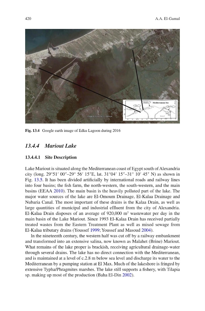
Fig. 13.4 Google earth image of Edku Lagoon during 2016
A.A. El-Gamal
13.4.4 Mariout Lake
13.4.4.1 Site Description
Lake Mariout is situated along the Mediterranean coast of Egypt south of Alexandria
city (long. 29°51′ 00″–29° 56′ 15″E, lat. 31°04′ 15″–31° 10′ 45″ N) as shown in
Fig. 13.5. It has been divided artificially by international roads and railway lines
into four basins; the fish farm, the north-western, the south-western, and the main
basins (EEAA 2010). The main basin is the heavily polluted part of the lake. The
major water sources of the lake are El-Omoum Drainage, El-Kalaa Drainage and
Nubaria Canal. The most important of these drains is the Kalaa Drain, as well as
large quantities of municipal and industrial effluent from the city of Alexandria.
El-Kalaa Drain disposes of an average of 920,000 m
3
wastewater per day in the
main basin of the Lake Mariout. Since 1993 El-Kalaa Drain has received partially
treated wastes from the Eastern Treatment Plant as well as mixed sewage from
El-Kalaa tributary drains (Youssef 1999; Youssef and Masoud 2004).
In the nineteenth century, the western half was cut off by a railway embankment
and transformed into an extensive salina, now known as Malahet (Brine) Mariout.
What remains of the lake proper is brackish, receiving agricultural drainage-water
through several drains. The lake has no direct connection with the Mediterranean,
and is maintained at a level of c.2.8 m below sea level and discharge its water to the
Mediterranean by a pumping station at El Max. Much of the lakeshore is fringed by
extensive Typha/Phragmites marshes. The lake still supports a fishery, with Tilapia
sp. making up most of the production (Baha El-Din 2002).
Fig. 13.4 Google earth image of Edku Lagoon during 2016
A.A. El-Gamal