

419
13.4.3 Edku Lagoon
13.4.3.1 Site Description
Edku Lake is coastal wetland located in the north of the Nile Delta west of the
Rosetta Nile branch and approximately 35 km east of Alexandria. It extends for
about 17 km in the east-west direction. It lies between latitudes of 31°10′ and 31°18′
N, and longitudes of 30° 8′ and 30° 22′ E (Fig. 13.4) (Youssef and Masoud 2004).
It is a shallow inland eutrophic lake with an average depth of 1 m. The mean annual
fish production from the lake is 9000 ton. The width of the lake (N-S direction) is
about 11 km at its widest part, where the narrowest part is only about 5 km (Masoud
et al. 2005). The lake is connected to the sea by El-Maadia outlet. The total area of
the lake is decreased from 30.000 to about 12.000 ha as a result of agricultural reclamation (Masoud et al. 2005). Two main drains namely Magrour Edku and Barsiek
discharge huge volumes of drainage water to the Lake. Magrour Edku Drain is
joined to different sources of drains. These Drains carry mainly agricultural, domestic and to less extent industrial effluents. The drainage water of more than 300 fish
farms is also disposed to El-Khaiy Drain directly before being connected with the
Lake. Barsiek Drain transports mainly agricultural drainage water to the Lake as
well as the waste of Barsiek fishing ponds (Youssef and Masoud 2004). The water
in the lake is mainly fresh (brackish), but increases in salinity towards the Bughaz
and during the summer (Baha El-Din 2002).
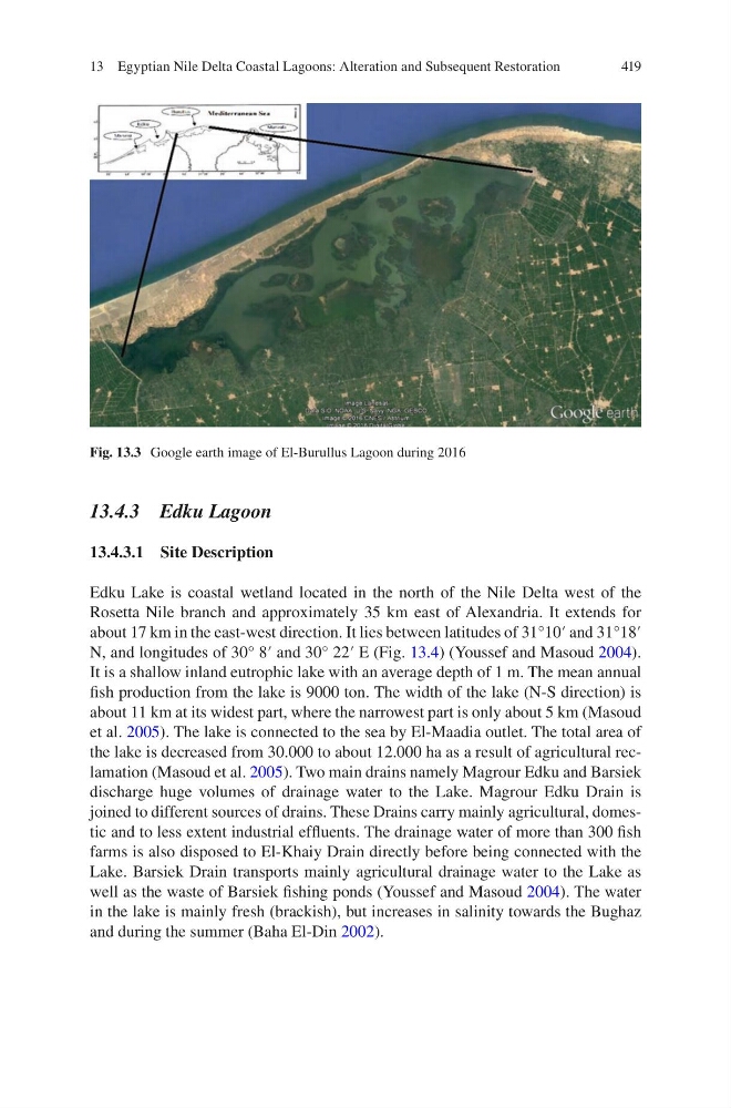
Fig. 13.3 Google earth image of El-Burullus Lagoon during 2016
13 Egyptian Nile Delta Coastal Lagoons: Alteration and Subsequent Restoration
13.4.3 Edku Lagoon
13.4.3.1 Site Description
Edku Lake is coastal wetland located in the north of the Nile Delta west of the
Rosetta Nile branch and approximately 35 km east of Alexandria. It extends for
about 17 km in the east-west direction. It lies between latitudes of 31°10′ and 31°18′
N, and longitudes of 30° 8′ and 30° 22′ E (Fig. 13.4) (Youssef and Masoud 2004).
It is a shallow inland eutrophic lake with an average depth of 1 m. The mean annual
fish production from the lake is 9000 ton. The width of the lake (N-S direction) is
about 11 km at its widest part, where the narrowest part is only about 5 km (Masoud
et al. 2005). The lake is connected to the sea by El-Maadia outlet. The total area of
the lake is decreased from 30.000 to about 12.000 ha as a result of agricultural reclamation (Masoud et al. 2005). Two main drains namely Magrour Edku and Barsiek
discharge huge volumes of drainage water to the Lake. Magrour Edku Drain is
joined to different sources of drains. These Drains carry mainly agricultural, domestic and to less extent industrial effluents. The drainage water of more than 300 fish
farms is also disposed to El-Khaiy Drain directly before being connected with the
Lake. Barsiek Drain transports mainly agricultural drainage water to the Lake as
well as the waste of Barsiek fishing ponds (Youssef and Masoud 2004). The water
in the lake is mainly fresh (brackish), but increases in salinity towards the Bughaz
and during the summer (Baha El-Din 2002).
Fig. 13.3 Google earth image of El-Burullus Lagoon during 2016
13 Egyptian Nile Delta Coastal Lagoons: Alteration and Subsequent Restoration