

366
complex and fish drying platforms are located. Mangrove forest with their zonation
patterns and areas of fisheries projects encircled by degraded forests is seen from
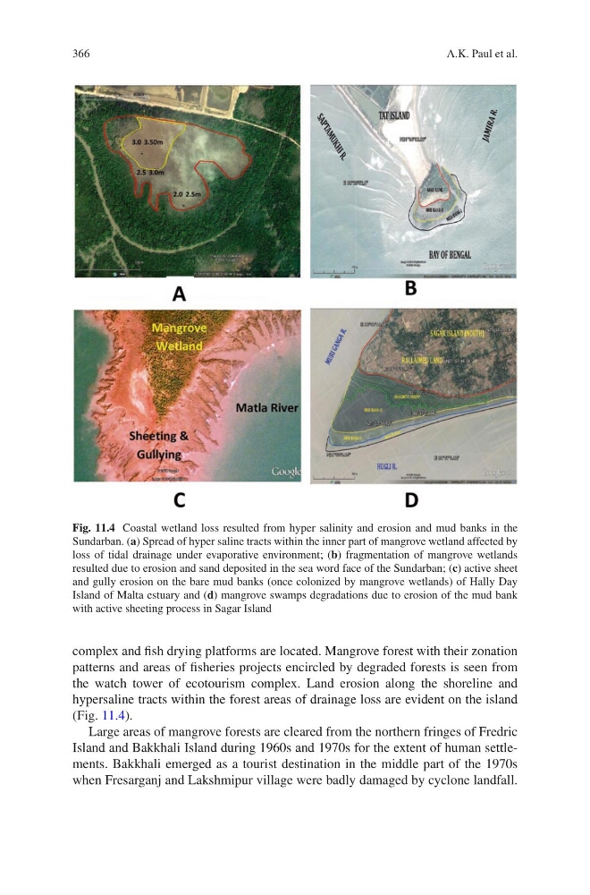
the watch tower of ecotourism complex. Land erosion along the shoreline and
hypersaline tracts within the forest areas of drainage loss are evident on the island
(Fig. 11.4).
Large areas of mangrove forests are cleared from the northern fringes of Fredric
Island and Bakkhali Island during 1960s and 1970s for the extent of human settlements. Bakkhali emerged as a tourist destination in the middle part of the 1970s
when Fresarganj and Lakshmipur village were badly damaged by cyclone landfall.
Fig. 11.4 Coastal wetland loss resulted from hyper salinity and erosion and mud banks in the
Sundarban. (a) Spread of hyper saline tracts within the inner part of mangrove wetland affected by
loss of tidal drainage under evaporative environment; (b) fragmentation of mangrove wetlands
resulted due to erosion and sand deposited in the sea word face of the Sundarban; (c) active sheet
and gully erosion on the bare mud banks (once colonized by mangrove wetlands) of Hally Day
Island of Malta estuary and (d) mangrove swamps degradations due to erosion of the mud bank
with active sheeting process in Sagar Island
A.K. Paul et al.
complex and fish drying platforms are located. Mangrove forest with their zonation
patterns and areas of fisheries projects encircled by degraded forests is seen from
the watch tower of ecotourism complex. Land erosion along the shoreline and
hypersaline tracts within the forest areas of drainage loss are evident on the island
(Fig. 11.4).
Large areas of mangrove forests are cleared from the northern fringes of Fredric
Island and Bakkhali Island during 1960s and 1970s for the extent of human settlements. Bakkhali emerged as a tourist destination in the middle part of the 1970s
when Fresarganj and Lakshmipur village were badly damaged by cyclone landfall.
Fig. 11.4 Coastal wetland loss resulted from hyper salinity and erosion and mud banks in the
Sundarban. (a) Spread of hyper saline tracts within the inner part of mangrove wetland affected by
loss of tidal drainage under evaporative environment; (b) fragmentation of mangrove wetlands
resulted due to erosion and sand deposited in the sea word face of the Sundarban; (c) active sheet
and gully erosion on the bare mud banks (once colonized by mangrove wetlands) of Hally Day
Island of Malta estuary and (d) mangrove swamps degradations due to erosion of the mud bank
with active sheeting process in Sagar Island
A.K. Paul et al.