

248
respectively, arrive in this wetland (Vilina 1994; Brito 1999; Victoriano et al. 2006;
Fariña et al. 2012; Vilina et al. 2014).
The inner lagoons were coastal lagoons in the past, but due to seismic displacements and elevations, they are in their current position (10 or more meters above sea
level and some km inland). However, they still conserve saline characteristics that
favor a high abundance and biodiversity of flora and fauna.
Contreras-López et al. (2014) described the current configuration of El Yali basin,
taking into account the big tectonic movements that occurred by the middle of the
Tertiary Period, and that provoked strong dislocations by faults on the coast of central Chile, along with a lifting of the Andean cordillera to its current level, the sinking of the longitudinal valley and the formation of the coastal cordillera (Noguera
1956). The small streams that originated in the coastal cordillera and flowed toward
the sea with tilted slopes deposited diverse coarse sediment whereas finer material
was swept along to the sea. New violent tectonic movements lifted the adjacent
seabed and formed the successive systems of marine terraces that can be observed
nowadays along these coasts. In particular, five main movements can be identified in
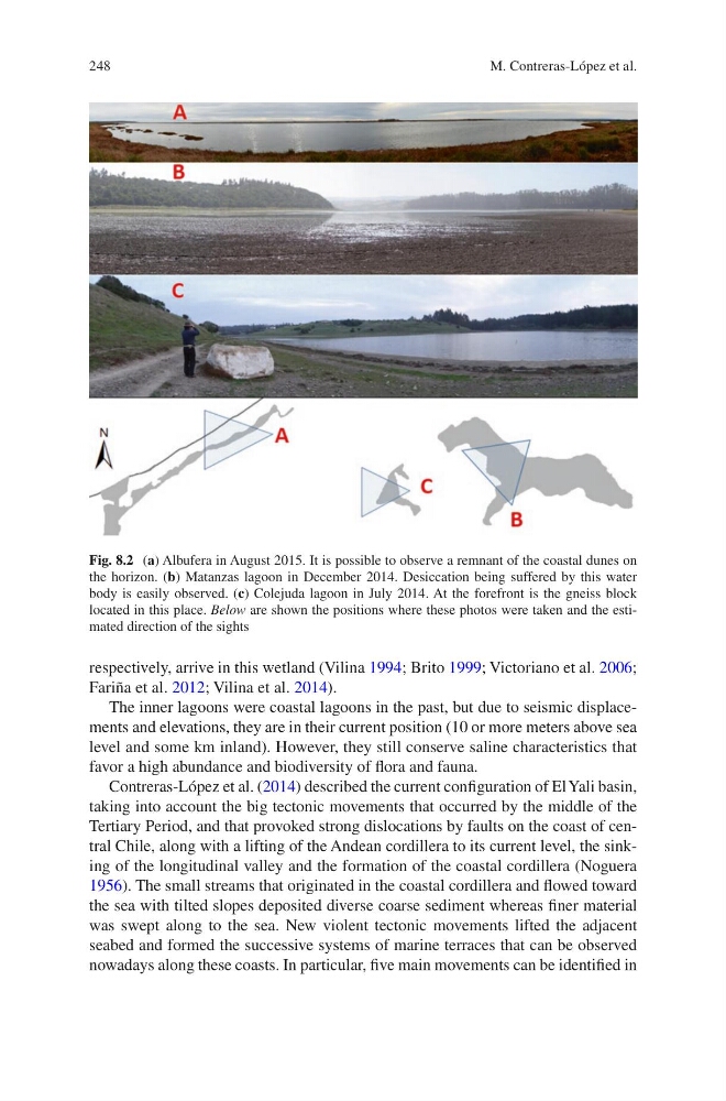
Fig. 8.2 (a) Albufera in August 2015. It is possible to observe a remnant of the coastal dunes on
the horizon. (b) Matanzas lagoon in December 2014. Desiccation being suffered by this water
body is easily observed. (c) Colejuda lagoon in July 2014. At the forefront is the gneiss block
located in this place. Below are shown the positions where these photos were taken and the estimated direction of the sights
M. Contreras-López et al.
respectively, arrive in this wetland (Vilina 1994; Brito 1999; Victoriano et al. 2006;
Fariña et al. 2012; Vilina et al. 2014).
The inner lagoons were coastal lagoons in the past, but due to seismic displacements and elevations, they are in their current position (10 or more meters above sea
level and some km inland). However, they still conserve saline characteristics that
favor a high abundance and biodiversity of flora and fauna.
Contreras-López et al. (2014) described the current configuration of El Yali basin,
taking into account the big tectonic movements that occurred by the middle of the
Tertiary Period, and that provoked strong dislocations by faults on the coast of central Chile, along with a lifting of the Andean cordillera to its current level, the sinking of the longitudinal valley and the formation of the coastal cordillera (Noguera
1956). The small streams that originated in the coastal cordillera and flowed toward
the sea with tilted slopes deposited diverse coarse sediment whereas finer material
was swept along to the sea. New violent tectonic movements lifted the adjacent
seabed and formed the successive systems of marine terraces that can be observed
nowadays along these coasts. In particular, five main movements can be identified in
Fig. 8.2 (a) Albufera in August 2015. It is possible to observe a remnant of the coastal dunes on
the horizon. (b) Matanzas lagoon in December 2014. Desiccation being suffered by this water
body is easily observed. (c) Colejuda lagoon in July 2014. At the forefront is the gneiss block
located in this place. Below are shown the positions where these photos were taken and the estimated direction of the sights
M. Contreras-López et al.