

92
P. Goethals· A. Dedecker· W. Gabriels . N. De Pauw
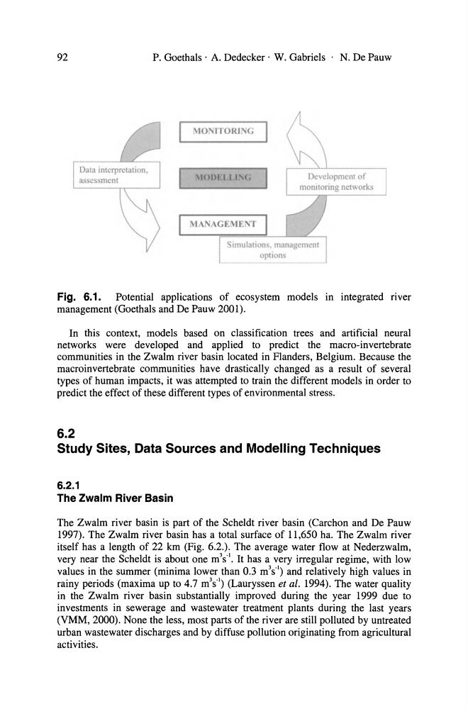
Fig. 6.1. Potential applications of ecosystem models In integrated flyer
management (Goethals and De Pauw 2001).
In this context, models based on classification trees and artificial neural
networks were developed and applied to predict the macro-invertebrate
communities in the Zwalm river basin located in Flanders, Belgium. Because the
macroinvertebrate communities have drastically changed as a result of several
types of human impacts, it was attempted to train the different models in order to
predict the effect of these different types of environmental stress.
6.2
Study Sites, Data Sources and Modelling Techniques
6.2.1
The Zwalm River Basin
The Zwalm river basin is part of the Scheldt river basin (Carchon and De Pauw
1997). The Zwalm river basin has a total surface of 11,650 ha. The Zwalm river
itself has a length of 22 km (Fig. 6.2.). The average water flow at Nederzwalm,
very near the Scheldt is about one m
3 s·
l • It has a very irregular regime, with low
values in the summer (minima lower than 0.3 m 3 s· l ) and relatively high values in
rainy periods (maxima up to 4.7 m 3 s· l ) (Lauryssen et al. 1994). The water quality
in the Zwalm river basin substantially improved during the year 1999 due to
investments in sewerage and wastewater treatment plants during the last years
(VMM, 2000). None the less, most parts of the river are still polluted by untreated
urban wastewater discharges and by diffuse pollution originating from agricultural
activities.
P. Goethals· A. Dedecker· W. Gabriels . N. De Pauw
Fig. 6.1. Potential applications of ecosystem models In integrated flyer
management (Goethals and De Pauw 2001).
In this context, models based on classification trees and artificial neural
networks were developed and applied to predict the macro-invertebrate
communities in the Zwalm river basin located in Flanders, Belgium. Because the
macroinvertebrate communities have drastically changed as a result of several
types of human impacts, it was attempted to train the different models in order to
predict the effect of these different types of environmental stress.
6.2
Study Sites, Data Sources and Modelling Techniques
6.2.1
The Zwalm River Basin
The Zwalm river basin is part of the Scheldt river basin (Carchon and De Pauw
1997). The Zwalm river basin has a total surface of 11,650 ha. The Zwalm river
itself has a length of 22 km (Fig. 6.2.). The average water flow at Nederzwalm,
very near the Scheldt is about one m
3 s·
l • It has a very irregular regime, with low
values in the summer (minima lower than 0.3 m 3 s· l ) and relatively high values in
rainy periods (maxima up to 4.7 m 3 s· l ) (Lauryssen et al. 1994). The water quality
in the Zwalm river basin substantially improved during the year 1999 due to
investments in sewerage and wastewater treatment plants during the last years
(VMM, 2000). None the less, most parts of the river are still polluted by untreated
urban wastewater discharges and by diffuse pollution originating from agricultural
activities.