

27.3 Intangible Elements
411
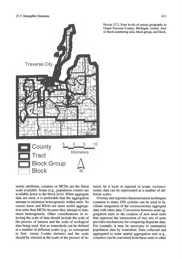
FIGURE 27.2. Four levels of census geography in
Grand Traverse County, Michigan: county, tract
or block numbering area, block group, and block.
County
I:] Tract
5
0
5
10
~~~Cl Block Group
D Block
Kilometers
A N
nomic attributes, counties or MCDs are the finest
scale available. Some (e.g., population counts) are
available down to the block level. When aggregate
data are used, it is preferable that the aggregation
attempt to minimize heterogeneity within units. So
census tracts and BNAs are more useful aggregation units than MCDs because they attempt to minimize heterogeneity. Other considerations in selecting the scale of data should include the scale of
the process of interest and the scale of ecological
data being used. Just as watersheds can be defined
at a number of different scales (e.g., to correspond
to first- versus 5-order streams) and the scale
should be selected at the scale of the process of interest, be it local or regional in scope, socioeconomic data can be represented at a number of different scales.
Overlay and regional characterization techniques
common to many GIS systems can be used to facilitate integration of the socioeconomic aggregate
data with other data. Conversion between areal aggregation units or the creation of new areal units
that represent the intersection of two sets of units
provides mechanisms for comparing disparate data.
For example, it may be necessary to summarize
population data by watershed. Data collected and
aggregated to some spatial aggregation unit (e.g.,
counties) can be converted from these units to other
411
FIGURE 27.2. Four levels of census geography in
Grand Traverse County, Michigan: county, tract
or block numbering area, block group, and block.
County
I:] Tract
5
0
5
10
~~~Cl Block Group
D Block
Kilometers
A N
nomic attributes, counties or MCDs are the finest
scale available. Some (e.g., population counts) are
available down to the block level. When aggregate
data are used, it is preferable that the aggregation
attempt to minimize heterogeneity within units. So
census tracts and BNAs are more useful aggregation units than MCDs because they attempt to minimize heterogeneity. Other considerations in selecting the scale of data should include the scale of
the process of interest and the scale of ecological
data being used. Just as watersheds can be defined
at a number of different scales (e.g., to correspond
to first- versus 5-order streams) and the scale
should be selected at the scale of the process of interest, be it local or regional in scope, socioeconomic data can be represented at a number of different scales.
Overlay and regional characterization techniques
common to many GIS systems can be used to facilitate integration of the socioeconomic aggregate
data with other data. Conversion between areal aggregation units or the creation of new areal units
that represent the intersection of two sets of units
provides mechanisms for comparing disparate data.
For example, it may be necessary to summarize
population data by watershed. Data collected and
aggregated to some spatial aggregation unit (e.g.,
counties) can be converted from these units to other