

24
An Overview of Ecological Assessment Principles and Applications
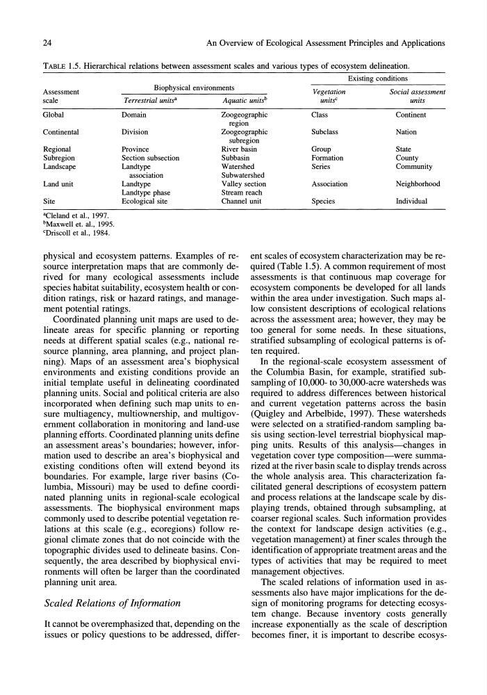
TABLE 1.5. Hierarchical relations between assessment scales and various types of ecosystem delineation.
Existing conditions
Biophysical environments
Assessment
scale
Terrestrial units a
Aquatic units b
Vegetation
units C
Social assessment
units
Global
Continental
Domain
Division
Zoogeographic
region
Zoogeographic
Class
Continent
Subclass
Nation
Regional
Subregion
Landscape
Land unit
Site
Province
Section subsection
Landtype
association
Landtype
Landtype phase
Ecological site
subregion
River basin
Subbasin
Watershed
Subwatershed
Valley section
Stream reach
Channel unit
Group
State
Formation
County
Series
Community
Association
Neighborhood
Species
Individual
"Cleland et aI., 1997.
bMaxwell et. aI., 1995.
cDriscoll et a!., 1984.
physical and ecosystem patterns. Examples of resource interpretation maps that are commonly derived for many ecological assessments include
species habitat suitability, ecosystem health or condition ratings, risk or hazard ratings, and management potential ratings.
Coordinated planning unit maps are used to delineate areas for specific planning or reporting
needs at different spatial scales (e.g., national resource planning, area planning, and project planning). Maps of an assessment area's biophysical
environments and existing conditions provide an
initial template useful in delineating coordinated
planning units. Social and political criteria are also
incorporated when defining such map units to ensure multiagency, multiownership, and multigovernment collaboration in monitoring and land-use
planning efforts. Coordinated planning units define
an assessment areas's boundaries; however, information used to describe an area's biophysical and
existing conditions often will extend beyond its
boundaries. For example, large river basins (Columbia, Missouri) may be used to define coordinated planning units in regional-scale ecological
assessments. The biophysical environment maps
commonly used to describe potential vegetation relations at this scale (e.g., ecoregions) follow regional climate zones that do not coincide with the
topographic divides used to delineate basins. Consequently, the area described by biophysical environments will often be larger than the coordinated
planning unit area.
Scaled Relations of Information
It cannot be overemphasized that, depending on the
issues or policy questions to be addressed, different scales of ecosystem characterization may be required (Table 1.5). A common requirement of most
assessments is that continuous map coverage for
ecosystem components be developed for all lands
within the area under investigation. Such maps allow consistent descriptions of ecological relations
across the assessment area; however, they may be
too general for some needs. In these situations,
stratified subsampling of ecological patterns is often required.
In the regional-scale ecosystem assessment of
the Columbia Basin, for example, stratified subsampling of 10,000- to 30,000-acre watersheds was
required to address differences between historical
and current vegetation patterns across the basin
(Quigley and Arbelbide, 1997). These watersheds
were selected on a stratified-random sampling basis using section-level terrestrial biophysical mapping units. Results of this analysis-changes in
vegetation cover type composition-were summarized at the river basin scale to display trends across
the whole analysis area. This characterization facilitated general descriptions of ecosystem pattern
and process relations at the landscape scale by displaying trends, obtained through subsampling, at
coarser regional scales. Such information provides
the context for landscape design activities (e.g.,
vegetation management) at finer scales through the
identification of appropriate treatment areas and the
types of activities that may be required to meet
management objectives.
The scaled relations of information used in assessments also have major implications for the design of monitoring programs for detecting ecosystem change. Because inventory costs generally
increase exponentially as the scale of description
becomes finer, it is important to describe ecosys-
An Overview of Ecological Assessment Principles and Applications
TABLE 1.5. Hierarchical relations between assessment scales and various types of ecosystem delineation.
Existing conditions
Biophysical environments
Assessment
scale
Terrestrial units a
Aquatic units b
Vegetation
units C
Social assessment
units
Global
Continental
Domain
Division
Zoogeographic
region
Zoogeographic
Class
Continent
Subclass
Nation
Regional
Subregion
Landscape
Land unit
Site
Province
Section subsection
Landtype
association
Landtype
Landtype phase
Ecological site
subregion
River basin
Subbasin
Watershed
Subwatershed
Valley section
Stream reach
Channel unit
Group
State
Formation
County
Series
Community
Association
Neighborhood
Species
Individual
"Cleland et aI., 1997.
bMaxwell et. aI., 1995.
cDriscoll et a!., 1984.
physical and ecosystem patterns. Examples of resource interpretation maps that are commonly derived for many ecological assessments include
species habitat suitability, ecosystem health or condition ratings, risk or hazard ratings, and management potential ratings.
Coordinated planning unit maps are used to delineate areas for specific planning or reporting
needs at different spatial scales (e.g., national resource planning, area planning, and project planning). Maps of an assessment area's biophysical
environments and existing conditions provide an
initial template useful in delineating coordinated
planning units. Social and political criteria are also
incorporated when defining such map units to ensure multiagency, multiownership, and multigovernment collaboration in monitoring and land-use
planning efforts. Coordinated planning units define
an assessment areas's boundaries; however, information used to describe an area's biophysical and
existing conditions often will extend beyond its
boundaries. For example, large river basins (Columbia, Missouri) may be used to define coordinated planning units in regional-scale ecological
assessments. The biophysical environment maps
commonly used to describe potential vegetation relations at this scale (e.g., ecoregions) follow regional climate zones that do not coincide with the
topographic divides used to delineate basins. Consequently, the area described by biophysical environments will often be larger than the coordinated
planning unit area.
Scaled Relations of Information
It cannot be overemphasized that, depending on the
issues or policy questions to be addressed, different scales of ecosystem characterization may be required (Table 1.5). A common requirement of most
assessments is that continuous map coverage for
ecosystem components be developed for all lands
within the area under investigation. Such maps allow consistent descriptions of ecological relations
across the assessment area; however, they may be
too general for some needs. In these situations,
stratified subsampling of ecological patterns is often required.
In the regional-scale ecosystem assessment of
the Columbia Basin, for example, stratified subsampling of 10,000- to 30,000-acre watersheds was
required to address differences between historical
and current vegetation patterns across the basin
(Quigley and Arbelbide, 1997). These watersheds
were selected on a stratified-random sampling basis using section-level terrestrial biophysical mapping units. Results of this analysis-changes in
vegetation cover type composition-were summarized at the river basin scale to display trends across
the whole analysis area. This characterization facilitated general descriptions of ecosystem pattern
and process relations at the landscape scale by displaying trends, obtained through subsampling, at
coarser regional scales. Such information provides
the context for landscape design activities (e.g.,
vegetation management) at finer scales through the
identification of appropriate treatment areas and the
types of activities that may be required to meet
management objectives.
The scaled relations of information used in assessments also have major implications for the design of monitoring programs for detecting ecosystem change. Because inventory costs generally
increase exponentially as the scale of description
becomes finer, it is important to describe ecosys-