

10.4 Remote Sensing and Ecosystem Management Examples
MAP UNIT: 3322
Mountain big sagebrush I Slender wheatgrass (ARTV2IELTR7, Amesmont Family - ARCA V,
Cambern Family ET - ARTV2IELTR7, Guiser Family ET Complex)
This map unit consists of lateral and recessional glacial moraines with intermorainal swales, potholes,
and kettles on moderately sloping undulating till plain. The ARTV2/ELTR7, Amesmont Family ET
occurs on dry moraine sideslopes, till plains, and dry swales. The ARCA V2, Cambern Family ET
occurs on moist positions including swales. The ARTRV2/ELTR7, Guiser Family ET occurs on dry
moraine crests and backslopes.
MAP UNIT COMPOSITION
40 Percent - Mountain big sagebrush/slender wheatgrass (ARTV2fELTR7, Amesmont Family ET)
25 Percent - Mountain silver sagebrush (ARCA V2. Cambern Family ET)
15 Percent - Mountain big sagebrush/slender wheatgrass (ARTRV2/ELTR7, Guiser Family ET)
20 Percent - Inclusions
PHYSICAL SETTINGS
Hierachy of Ecological Units: Union Pass Uplands Subsection of the Overthrust Mountains Section
General Location: Mosquito Lake
Landform: Pinedale recessional moraines and till plains, including intennorainal swales, kettles, and swales
Parent Material: Pinedale glacial till dominantly crystalline granitics and granodiorites with lesser amounts
of sedimentary rock fragments.
Elevation: 8000 to 9000 feet
Slope:
0 to 20 percent
Aspect:
All
Annual Precipitation: 21 to 24 in.
Areal Extent:
3822 acres
147
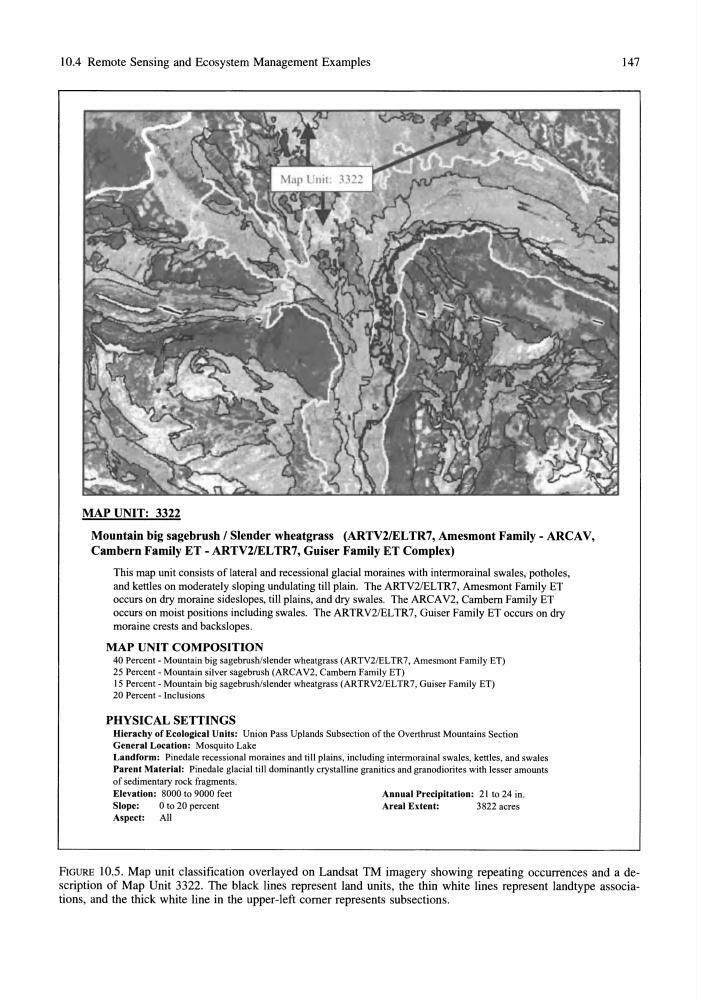
FIGURE 10.5. Map unit classification overlayed on Landsat TM imagery showing repeating occurrences and a description of Map Unit 3322. The black lines represent land units, the thin white lines represent landtype associations, and the thick white line in the upper-left comer represents subsections.
MAP UNIT: 3322
Mountain big sagebrush I Slender wheatgrass (ARTV2IELTR7, Amesmont Family - ARCA V,
Cambern Family ET - ARTV2IELTR7, Guiser Family ET Complex)
This map unit consists of lateral and recessional glacial moraines with intermorainal swales, potholes,
and kettles on moderately sloping undulating till plain. The ARTV2/ELTR7, Amesmont Family ET
occurs on dry moraine sideslopes, till plains, and dry swales. The ARCA V2, Cambern Family ET
occurs on moist positions including swales. The ARTRV2/ELTR7, Guiser Family ET occurs on dry
moraine crests and backslopes.
MAP UNIT COMPOSITION
40 Percent - Mountain big sagebrush/slender wheatgrass (ARTV2fELTR7, Amesmont Family ET)
25 Percent - Mountain silver sagebrush (ARCA V2. Cambern Family ET)
15 Percent - Mountain big sagebrush/slender wheatgrass (ARTRV2/ELTR7, Guiser Family ET)
20 Percent - Inclusions
PHYSICAL SETTINGS
Hierachy of Ecological Units: Union Pass Uplands Subsection of the Overthrust Mountains Section
General Location: Mosquito Lake
Landform: Pinedale recessional moraines and till plains, including intennorainal swales, kettles, and swales
Parent Material: Pinedale glacial till dominantly crystalline granitics and granodiorites with lesser amounts
of sedimentary rock fragments.
Elevation: 8000 to 9000 feet
Slope:
0 to 20 percent
Aspect:
All
Annual Precipitation: 21 to 24 in.
Areal Extent:
3822 acres
147
FIGURE 10.5. Map unit classification overlayed on Landsat TM imagery showing repeating occurrences and a description of Map Unit 3322. The black lines represent land units, the thin white lines represent landtype associations, and the thick white line in the upper-left comer represents subsections.