

136
Remote Sensing Applied to Ecosystem Management
• Existing Vegetation
• Heritage Resource Surveys
• Terrestrial Ecological Units
-,....---------, • Threatened and Endangered
• Ownership and Land Surveys
• Range Allotments
• Recreation Sites
• Restrictions and Rights
* Roads
• Streams
Range AllotmenlS
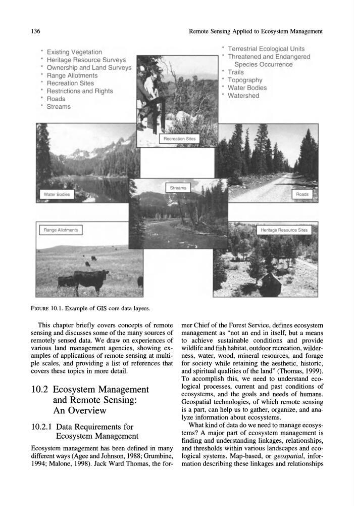
FIGURE 10.1. Example of GIS core data layers.
This chapter briefly covers concepts of remote
sensing and discusses some of the many sources of
remotely sensed data. We draw on experiences of
various land management agencies, showing examples of applications of remote sensing at multiple scales, and providing a list of references that
covers these topics in more detail.
10.2 Ecosystem Management
and Remote Sensing:
An Overview
10.2.1 Data Requirements for
Ecosystem Management
Ecosystem management has been defined in many
different ways (Agee and Johnson, 1988; Grumbine,
1994; Malone, 1998). Jack Ward Thomas, the forSpecies Occurrence
• Trails
• Topography
• Water Bodies
• Watershed
mer Chief of the Forest Service, defines ecosystem
management as "not an end in itself, but a means
to achieve sustainable conditions and provide
wildlife and fish habitat, outdoor recreation, wilderness, water, wood, mineral resources, and forage
for society while retaining the aesthetic, historic,
and spiritual qualities of the land" (Thomas, 1999).
To accomplish this, we need to understand ecological processes, current and past conditions of
ecosystems, and the goals and needs of humans.
Geospatial technologies, of which remote sensing
is a part, can help us to gather, organize, and analyze information about ecosystems.
What kind of data do we need to manage ecosystems? A major part of ecosystem management is
finding and understanding linkages, relationships,
and thresholds within various landscapes and ecological systems. Map-based, or geospatial, information describing these linkages and relationships
Remote Sensing Applied to Ecosystem Management
• Existing Vegetation
• Heritage Resource Surveys
• Terrestrial Ecological Units
-,....---------, • Threatened and Endangered
• Ownership and Land Surveys
• Range Allotments
• Recreation Sites
• Restrictions and Rights
* Roads
• Streams
Range AllotmenlS
FIGURE 10.1. Example of GIS core data layers.
This chapter briefly covers concepts of remote
sensing and discusses some of the many sources of
remotely sensed data. We draw on experiences of
various land management agencies, showing examples of applications of remote sensing at multiple scales, and providing a list of references that
covers these topics in more detail.
10.2 Ecosystem Management
and Remote Sensing:
An Overview
10.2.1 Data Requirements for
Ecosystem Management
Ecosystem management has been defined in many
different ways (Agee and Johnson, 1988; Grumbine,
1994; Malone, 1998). Jack Ward Thomas, the forSpecies Occurrence
• Trails
• Topography
• Water Bodies
• Watershed
mer Chief of the Forest Service, defines ecosystem
management as "not an end in itself, but a means
to achieve sustainable conditions and provide
wildlife and fish habitat, outdoor recreation, wilderness, water, wood, mineral resources, and forage
for society while retaining the aesthetic, historic,
and spiritual qualities of the land" (Thomas, 1999).
To accomplish this, we need to understand ecological processes, current and past conditions of
ecosystems, and the goals and needs of humans.
Geospatial technologies, of which remote sensing
is a part, can help us to gather, organize, and analyze information about ecosystems.
What kind of data do we need to manage ecosystems? A major part of ecosystem management is
finding and understanding linkages, relationships,
and thresholds within various landscapes and ecological systems. Map-based, or geospatial, information describing these linkages and relationships