

26
3 Study Area
3.3
Hydrographic Conditions in the Spiekeroog Backbarrier
System
Verena Niesel
Tidal areas are highly dynamic marine systems, which are strongly influenced by
tidal cycles. Tidal currents move water masses horizontally and vertically. They
can reach high velocities and their forces have consequences on the morphology of
the area as well as on the colonization of organisms.
Hydrographical conditions were both measured and simulated within the
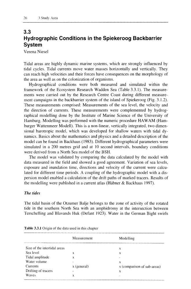
framework of the Ecosystem Research Wadden Sea (Table 3.3.1). The measurements were carried out by the Research Centre Coast during different measurement campaigns in the backbarrier system of the island of Spiekeroog (Fig. 3. J .2).
These measurements comprised: Measurements of the sea level, the velocity and
the direction of currents. These measurements were complemented by hydrographical modelling done by the Institute of Marine Science of the University of
Hamburg. Modelling was performed with the numeric procedure HAW AM (Hamburger Wattenmeer Modell). This is a non-linear, vertically integrated, two dimensional barotropic model, which was developed for shallow waters with tidal dynamics. Basics about the mathematics and physics and a detailed description of the
model can be found in Backhaus (1983). Different hydrographical parameters were
simulated in a 200 metres grid and at 10 second intervals, boundary conditions
were derived from a North Sea model of the BSH.
The model was validated by comparing the data calculated by the model with
data measured in the field and showed a good agreement. Variation of sea levels,
exposure and inundation time, directions and velocity of the current were calculated for different time periods. A coupling of the hydrographic model with a dispersion model enabled a calculation of the drift paths of marked tracers. Results of
the modelling were published in a current atlas (Hi.ibner & Backhaus 1997).
The tides
The tidal basin of the Otzumer Balje belongs to the zone of activity of the rotated
tide in the southern North Sea with an amphidromy at the intersection between
Terschelling and Blavands Huk (Defant 1923). Water in the German Bight swirls
Table 3.3.1 Origin of the data used in this chapter
Size of the intertidal areas
Sea level
Tidal amplitude
Water volume
Currents
Drifting of tracers
Waves
Measurement
x
x
x (general)
x
Modelling
x
x
x
x (comparison of sub-areas)
x
3 Study Area
3.3
Hydrographic Conditions in the Spiekeroog Backbarrier
System
Verena Niesel
Tidal areas are highly dynamic marine systems, which are strongly influenced by
tidal cycles. Tidal currents move water masses horizontally and vertically. They
can reach high velocities and their forces have consequences on the morphology of
the area as well as on the colonization of organisms.
Hydrographical conditions were both measured and simulated within the
framework of the Ecosystem Research Wadden Sea (Table 3.3.1). The measurements were carried out by the Research Centre Coast during different measurement campaigns in the backbarrier system of the island of Spiekeroog (Fig. 3. J .2).
These measurements comprised: Measurements of the sea level, the velocity and
the direction of currents. These measurements were complemented by hydrographical modelling done by the Institute of Marine Science of the University of
Hamburg. Modelling was performed with the numeric procedure HAW AM (Hamburger Wattenmeer Modell). This is a non-linear, vertically integrated, two dimensional barotropic model, which was developed for shallow waters with tidal dynamics. Basics about the mathematics and physics and a detailed description of the
model can be found in Backhaus (1983). Different hydrographical parameters were
simulated in a 200 metres grid and at 10 second intervals, boundary conditions
were derived from a North Sea model of the BSH.
The model was validated by comparing the data calculated by the model with
data measured in the field and showed a good agreement. Variation of sea levels,
exposure and inundation time, directions and velocity of the current were calculated for different time periods. A coupling of the hydrographic model with a dispersion model enabled a calculation of the drift paths of marked tracers. Results of
the modelling were published in a current atlas (Hi.ibner & Backhaus 1997).
The tides
The tidal basin of the Otzumer Balje belongs to the zone of activity of the rotated
tide in the southern North Sea with an amphidromy at the intersection between
Terschelling and Blavands Huk (Defant 1923). Water in the German Bight swirls
Table 3.3.1 Origin of the data used in this chapter
Size of the intertidal areas
Sea level
Tidal amplitude
Water volume
Currents
Drifting of tracers
Waves
Measurement
x
x
x (general)
x
Modelling
x
x
x
x (comparison of sub-areas)
x