

254
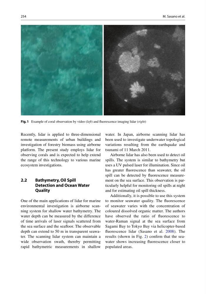
Recently, lidar is applied to three-dimensional
remote measurements of urban buildings and
investigation of forestry biomass using airborne
platform. The present study employs lidar for
observing corals and is expected to help extend
the range of this technology to various marine
ecosystem investigations.
2.2
Bathymetry, Oil Spill
Detection and Ocean Water
Quality
One of the main applications of lidar for marine
environmental investigation is airborne scanning system for shallow water bathymetry. The
water depth can be measured by the difference
of time arrivals of laser signals scattered from
the sea surface and the seafl oor. The observable
depth can extend to 50 m in transparent seawater. The scanning lidar system can maintain a
wide observation swath, thereby permitting
rapid bathymetric measurements in shallow
water. In Japan, airborne scanning lidar has
been used to investigate underwater topological
variations resulting from the earthquake and
tsunami of 11 March 2011.
Airborne lidar has also been used to detect oil
spills. The system is similar to bathymetry but
uses a UV pulsed laser for illumination. Since oil
has greater fl uorescence than seawater, the oil
spill can be detected by fl uorescence measurement on the sea surface. This observation is particularly helpful for monitoring oil spills at night
and for estimating oil spill thickness.
Additionally, it is possible to use this system
to monitor seawater quality. The fl uorescence
of seawater varies with the concentration of
coloured dissolved organic matter. The authors
have observed the ratio of fl uorescence to
water- Raman signal at the sea surface from
Sagami Bay to Tokyo Bay via helicopter-based
fl uorescence lidar (Sasano et al. 2008 ). The
results (shown in Fig. 2 ) confi rm that the seawater shows increasing fl uorescence closer to
populated areas.
Fig. 1 Example of coral observation by video ( left ) and fl uorescence imaging lidar ( right )
M. Sasano et al.
Recently, lidar is applied to three-dimensional
remote measurements of urban buildings and
investigation of forestry biomass using airborne
platform. The present study employs lidar for
observing corals and is expected to help extend
the range of this technology to various marine
ecosystem investigations.
2.2
Bathymetry, Oil Spill
Detection and Ocean Water
Quality
One of the main applications of lidar for marine
environmental investigation is airborne scanning system for shallow water bathymetry. The
water depth can be measured by the difference
of time arrivals of laser signals scattered from
the sea surface and the seafl oor. The observable
depth can extend to 50 m in transparent seawater. The scanning lidar system can maintain a
wide observation swath, thereby permitting
rapid bathymetric measurements in shallow
water. In Japan, airborne scanning lidar has
been used to investigate underwater topological
variations resulting from the earthquake and
tsunami of 11 March 2011.
Airborne lidar has also been used to detect oil
spills. The system is similar to bathymetry but
uses a UV pulsed laser for illumination. Since oil
has greater fl uorescence than seawater, the oil
spill can be detected by fl uorescence measurement on the sea surface. This observation is particularly helpful for monitoring oil spills at night
and for estimating oil spill thickness.
Additionally, it is possible to use this system
to monitor seawater quality. The fl uorescence
of seawater varies with the concentration of
coloured dissolved organic matter. The authors
have observed the ratio of fl uorescence to
water- Raman signal at the sea surface from
Sagami Bay to Tokyo Bay via helicopter-based
fl uorescence lidar (Sasano et al. 2008 ). The
results (shown in Fig. 2 ) confi rm that the seawater shows increasing fl uorescence closer to
populated areas.
Fig. 1 Example of coral observation by video ( left ) and fl uorescence imaging lidar ( right )
M. Sasano et al.