

Methods Used in a Mass-Balance Study of Holocene Sediment Accumulation on the ...
369
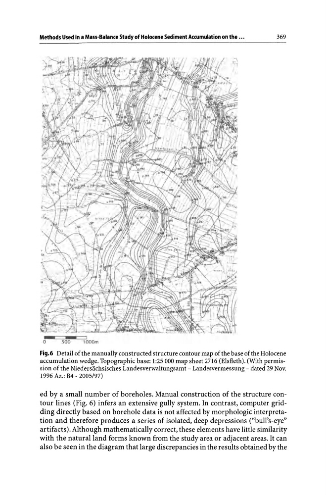
Fig.6 Detail of the manually constructed structure contour map of the base of the Holocene
accumulation wedge. Topographic base: 1:25000 map sheet 2716 (Elsfleth). (With permission of the Niedersachsisches Landesverwaltungsamt - Landesvermessung - dated 29 Nov.
1996 Az.: B4 - 2005/97)
ed by a small number of boreholes. Manual construction of the structure contour lines (Fig. 6) infers an extensive gully system. In contrast, computer gridding directly based on borehole data is not affected by morphologic interpretation and therefore produces a series of isolated, deep depressions ("bull's-eye"
artifacts). Although mathematically correct, these elements have little similarity
with the natural land forms known from the study area or adjacent areas. It can
also be seen in the diagram that large discrepancies in the results obtained by the
369
Fig.6 Detail of the manually constructed structure contour map of the base of the Holocene
accumulation wedge. Topographic base: 1:25000 map sheet 2716 (Elsfleth). (With permission of the Niedersachsisches Landesverwaltungsamt - Landesvermessung - dated 29 Nov.
1996 Az.: B4 - 2005/97)
ed by a small number of boreholes. Manual construction of the structure contour lines (Fig. 6) infers an extensive gully system. In contrast, computer gridding directly based on borehole data is not affected by morphologic interpretation and therefore produces a series of isolated, deep depressions ("bull's-eye"
artifacts). Although mathematically correct, these elements have little similarity
with the natural land forms known from the study area or adjacent areas. It can
also be seen in the diagram that large discrepancies in the results obtained by the