

342
W. L. Watney . J. Kruger· J. c. Davis· J. Harff . R. A. Olea, . G. C. Bohling
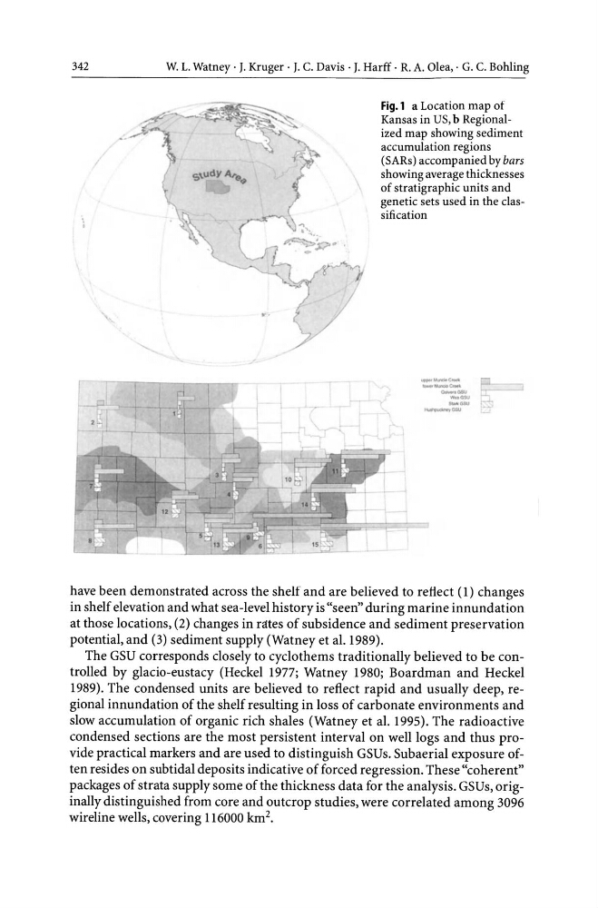
Fig.l a Location map of
Kansas in US, b Regionalized map showing sediment
accumulation regions
(SARs) accompanied by bars
showing average thicknesses
of stratigraphic units and
genetic sets used in the classification
--- --- 0-._ -"'"
_ ....
-"'"
have been demonstrated across the shelf and are believed to refiect (1) changes
in shelf elevation and what sea-level history is "seen" during marine innundation
at those locations, (2) changes in rates of subsidence and sediment preservation
potential, and (3) sediment supply (Watney et al.1989).
The GSU corresponds closely to cyclothems traditionally believed to be controlled by glacio-eustacy (Heckel 1977; Watney 1980; Boardman and Heckel
1989). The condensed units are believed to reflect rapid and usually deep, regional innundation of the shelf resulting in loss of carbonate environments and
slow accumulation of organic rich shales (Watney et al. 1995). The radioactive
condensed sections are the most persistent interval on well logs and thus provide practical markers and are used to distinguish GSUs. Subaerial exposure often resides on subtidal deposits indicative of forced regression. These "coherent"
packages of strata supply some of the thickness data for the analysis. GSUs, originally distinguished from core and outcrop studies, were correlated among 3096
wireline wells, covering 116000 km 2 •
W. L. Watney . J. Kruger· J. c. Davis· J. Harff . R. A. Olea, . G. C. Bohling
Fig.l a Location map of
Kansas in US, b Regionalized map showing sediment
accumulation regions
(SARs) accompanied by bars
showing average thicknesses
of stratigraphic units and
genetic sets used in the classification
--- --- 0-._ -"'"
_ ....
-"'"
have been demonstrated across the shelf and are believed to refiect (1) changes
in shelf elevation and what sea-level history is "seen" during marine innundation
at those locations, (2) changes in rates of subsidence and sediment preservation
potential, and (3) sediment supply (Watney et al.1989).
The GSU corresponds closely to cyclothems traditionally believed to be controlled by glacio-eustacy (Heckel 1977; Watney 1980; Boardman and Heckel
1989). The condensed units are believed to reflect rapid and usually deep, regional innundation of the shelf resulting in loss of carbonate environments and
slow accumulation of organic rich shales (Watney et al. 1995). The radioactive
condensed sections are the most persistent interval on well logs and thus provide practical markers and are used to distinguish GSUs. Subaerial exposure often resides on subtidal deposits indicative of forced regression. These "coherent"
packages of strata supply some of the thickness data for the analysis. GSUs, originally distinguished from core and outcrop studies, were correlated among 3096
wireline wells, covering 116000 km 2 •