

4 Extraction of Intermediate Scale Sea Ice Deformation Parameters from SAR Ice Motion Products
75
4.3.1
The Tie Point Locator
An ASF ice motion product covers the overlapped area of two images in a selected image
pair whose times of acquisition are usually separated by periods of multiples of 3 days.
The product provides the geographic locations of both ends of an ice motion vector.
The two ends of each vector form a tie. Although the ice motion file itself is not a grid
file, a grid file can be produced from it by using a tie point locator that focuses only on
the geographic location of the starting point of a tie. This is the case because the starting positions of the ice motion vectors are evenly spaced on the SSM!! projection and
therefore can be directly converted into grid locations. The actual procedure involves
two steps: (1) converting the geographic location (i.e., the latitude and longitude of each
tie point) into Cartesian coordinates, and (2) deriving grid coordinates, i.e., row and
column positions from the Cartesian coordinates. Conversion between the geographic coordinates and ilie SSM!! coordinates is well defined (Bonbright 1984). The conversion of the Cartesian coordinates X, Yinto grid coordinates i,j is made by the following formulas:
. (Y -Y min )
1=
,
(3)
L1Y
where Xmin and Y min are ilie minimum Cartesian coordinate values found in the particular ice motion file and AX and L1 Yare the grid sizes in the X and Y dimensions. For
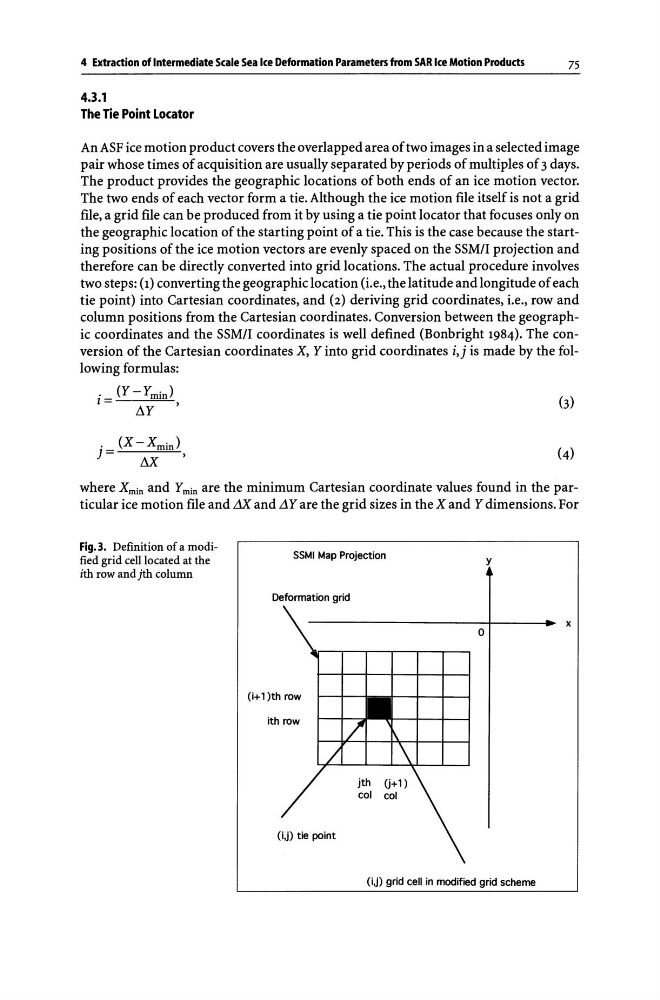
Fig.3. Definition of a modified grid cell located at the
ith row and jth column
SSMI Map Projection
y
Deformation grid
o
(i+l )th row
ith row
(i,j) tie point
(i,j) grid cell in modified grid scheme
x
75
4.3.1
The Tie Point Locator
An ASF ice motion product covers the overlapped area of two images in a selected image
pair whose times of acquisition are usually separated by periods of multiples of 3 days.
The product provides the geographic locations of both ends of an ice motion vector.
The two ends of each vector form a tie. Although the ice motion file itself is not a grid
file, a grid file can be produced from it by using a tie point locator that focuses only on
the geographic location of the starting point of a tie. This is the case because the starting positions of the ice motion vectors are evenly spaced on the SSM!! projection and
therefore can be directly converted into grid locations. The actual procedure involves
two steps: (1) converting the geographic location (i.e., the latitude and longitude of each
tie point) into Cartesian coordinates, and (2) deriving grid coordinates, i.e., row and
column positions from the Cartesian coordinates. Conversion between the geographic coordinates and ilie SSM!! coordinates is well defined (Bonbright 1984). The conversion of the Cartesian coordinates X, Yinto grid coordinates i,j is made by the following formulas:
. (Y -Y min )
1=
,
(3)
L1Y
where Xmin and Y min are ilie minimum Cartesian coordinate values found in the particular ice motion file and AX and L1 Yare the grid sizes in the X and Y dimensions. For
Fig.3. Definition of a modified grid cell located at the
ith row and jth column
SSMI Map Projection
y
Deformation grid
o
(i+l )th row
ith row
(i,j) tie point
(i,j) grid cell in modified grid scheme
x