

12 Towards Operational Monitoring of Arctic Sea Ice by SAR
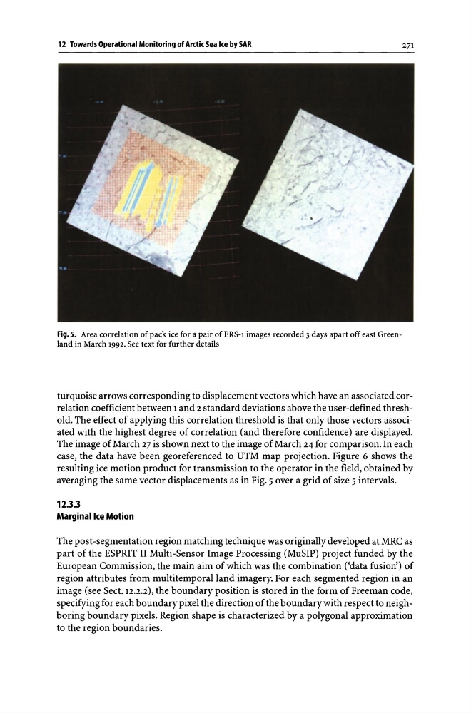
Fig.S. Area correlation of pack ice for a pair of ERS-1 images recorded 3 days apart off east Greenland in March 1992. See text for further details
271
turquoise arrows corresponding to displacement vectors which have an associated correlation coefficient between 1 and 2 standard deviations above the user-defined threshold. The effect of applying this correlation threshold is that only those vectors associated with the highest degree of correlation (and therefore confidence) are displayed.
The image of March 27 is shown next to the image of March 24 for comparison. In each
case, the data have been georeferenced to UTM map projection. Figure 6 shows the
resulting ice motion product for transmission to the operator in the field, obtained by
averaging the same vector displacements as in Fig. 5 over a grid of size 5 intervals.
12.3.3
Marginal Ice Motion
The post -segmentation region matching technique was originally developed at MRC as
part of the ESPRIT II Multi-Sensor Image Processing (MuSIP) project funded by the
European Commission, the main aim of which was the combination ('data fusion') of
region attributes from multi temporal land imagery. For each segmented region in an
image (see Sect. 12.2.2), the boundary position is stored in the form of Freeman code,
specifying for each boundary pixel the direction of the boundary with respect to neighboring boundary pixels. Region shape is characterized by a polygonal approximation
to the region boundaries.
Fig.S. Area correlation of pack ice for a pair of ERS-1 images recorded 3 days apart off east Greenland in March 1992. See text for further details
271
turquoise arrows corresponding to displacement vectors which have an associated correlation coefficient between 1 and 2 standard deviations above the user-defined threshold. The effect of applying this correlation threshold is that only those vectors associated with the highest degree of correlation (and therefore confidence) are displayed.
The image of March 27 is shown next to the image of March 24 for comparison. In each
case, the data have been georeferenced to UTM map projection. Figure 6 shows the
resulting ice motion product for transmission to the operator in the field, obtained by
averaging the same vector displacements as in Fig. 5 over a grid of size 5 intervals.
12.3.3
Marginal Ice Motion
The post -segmentation region matching technique was originally developed at MRC as
part of the ESPRIT II Multi-Sensor Image Processing (MuSIP) project funded by the
European Commission, the main aim of which was the combination ('data fusion') of
region attributes from multi temporal land imagery. For each segmented region in an
image (see Sect. 12.2.2), the boundary position is stored in the form of Freeman code,
specifying for each boundary pixel the direction of the boundary with respect to neighboring boundary pixels. Region shape is characterized by a polygonal approximation
to the region boundaries.