

11 The RADARSAT Geophysical Processor System
241
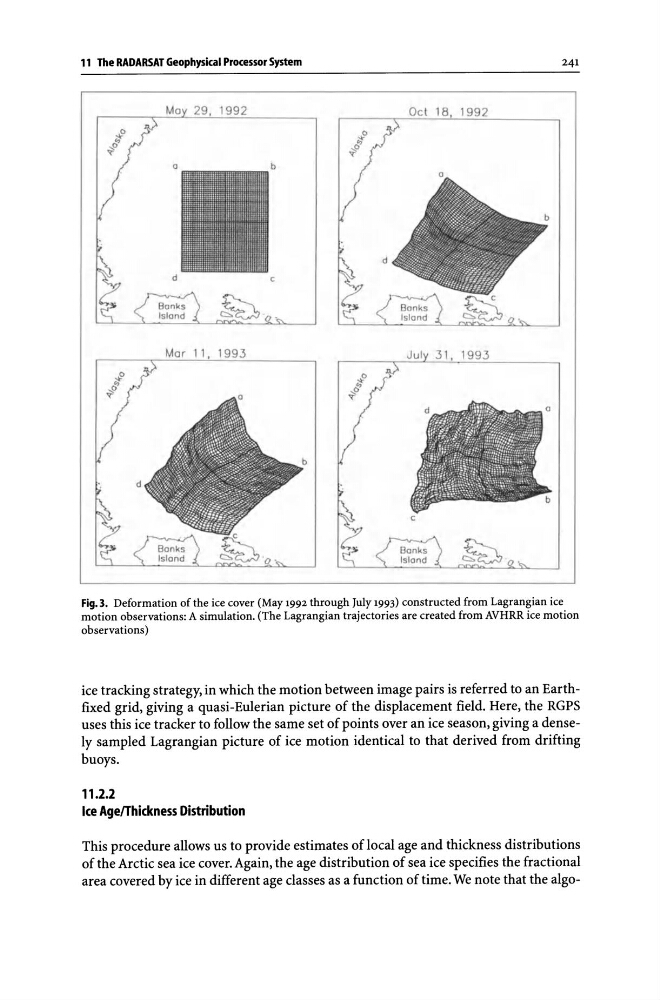
Fig.3. Deformation of the ice cover (May 1992 through July 1993) constructed from Lagrangian ice
motion observations: A simulation. (The Lagrangian trajectories are created from AVHRR ice motion
observations)
ice tracking strategy, in which the motion between image pairs is referred to an Earthfixed grid, giving a quasi-Eulerian picture of the displacement field. Here, the RGPS
uses this ice tracker to follow the same set of points over an ice season, giving a densely sampled Lagrangian picture of ice motion identical to that derived from drifting
buoys.
11.2.2
Ice Age/Thickness Distribution
This procedure allows us to provide estimates of local age and thickness distributions
of the Arctic sea ice cover. Again, the age distribution of sea ice specifies the fractional
area covered by ice in different age classes as a function of time. We note that the algo-
241
Fig.3. Deformation of the ice cover (May 1992 through July 1993) constructed from Lagrangian ice
motion observations: A simulation. (The Lagrangian trajectories are created from AVHRR ice motion
observations)
ice tracking strategy, in which the motion between image pairs is referred to an Earthfixed grid, giving a quasi-Eulerian picture of the displacement field. Here, the RGPS
uses this ice tracker to follow the same set of points over an ice season, giving a densely sampled Lagrangian picture of ice motion identical to that derived from drifting
buoys.
11.2.2
Ice Age/Thickness Distribution
This procedure allows us to provide estimates of local age and thickness distributions
of the Arctic sea ice cover. Again, the age distribution of sea ice specifies the fractional
area covered by ice in different age classes as a function of time. We note that the algo-