

5.8 Freak Wave Problem
219
Agulhas current
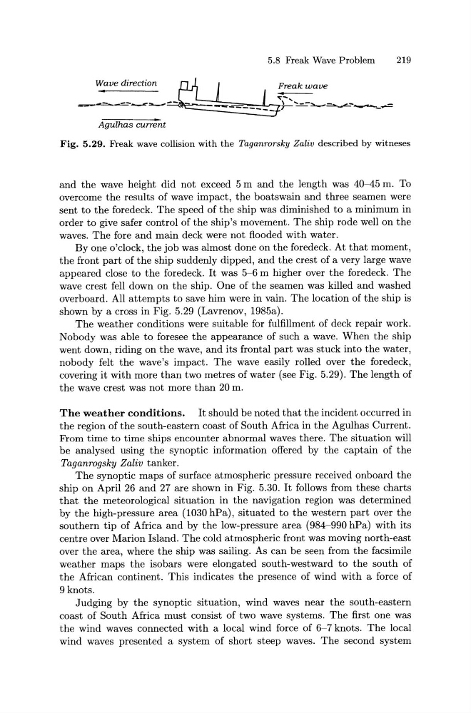
Fig. 5.29. Freak wave collision with the Taganrorsky Zaliv described by witneses
and the wave height did not exceed 5 m and the length was 40-45 m. To
overcome the results of wave impact, the boatswain and three seamen were
sent to the foredeck. The speed of the ship was diminished to a minimum in
order to give safer control of the ship's movement. The ship rode well on the
waves. The fore and main deck were not flooded with water.
By one o'clock, the job was almost done on the foredeck. At that moment,
the front part of the ship suddenly dipped, and the crest of a very large wave
appeared close to the foredeck. It was 5-6 m higher over the foredeck. The
wave crest fell down on the ship. One of the seamen was killed and washed
overboard. All attempts to save him were in vain. The location of the ship is
shown by a cross in Fig. 5.29 (Lavrenov, 1985a).
The weather conditions were suitable for fulfillment of deck repair work.
Nobody was able to foresee the appearance of such a wave. When the ship
went down, riding on the wave, and its frontal part was stuck into the water,
nobody felt the wave's impact. The wave easily rolled over the foredeck,
covering it with more than two metres of water (see Fig. 5.29). The length of
the wave crest was not more than 20 m.
The weather conditions. It should be noted that the incident occurred in
the region of the south-eastern coast of South Africa in the Agulhas Current.
From time to time ships encounter abnormal waves there. The situation will
be analysed using the synoptic information offered by the captain of the
Taganrogsky Zaliv tanker.
The synoptic maps of surface atmospheric pressure received onboard the
ship on April 26 and 27 are shown in Fig. 5.30. It follows from these charts
that the meteorological situation in the navigation region was determined
by the high-pressure area (1030 hPa), situated to the western part over the
southern tip of Africa and by the low-pressure area (984-990 hPa) with its
centre over Marion Island. The cold atmospheric front was moving north-east
over the area, where the ship was sailing. As can be seen from the facsimile
weather maps the isobars were elongated south-westward to the south of
the African continent. This indicates the presence of wind with a force of
9 knots.
Judging by the synoptic situation, wind waves near the south-eastern
coast of South Africa must consist of two wave systems. The first one was
the wind waves connected with a local wind force of 6-7 knots. The local
wind waves presented a system of short steep waves. The second system
219
Agulhas current
Fig. 5.29. Freak wave collision with the Taganrorsky Zaliv described by witneses
and the wave height did not exceed 5 m and the length was 40-45 m. To
overcome the results of wave impact, the boatswain and three seamen were
sent to the foredeck. The speed of the ship was diminished to a minimum in
order to give safer control of the ship's movement. The ship rode well on the
waves. The fore and main deck were not flooded with water.
By one o'clock, the job was almost done on the foredeck. At that moment,
the front part of the ship suddenly dipped, and the crest of a very large wave
appeared close to the foredeck. It was 5-6 m higher over the foredeck. The
wave crest fell down on the ship. One of the seamen was killed and washed
overboard. All attempts to save him were in vain. The location of the ship is
shown by a cross in Fig. 5.29 (Lavrenov, 1985a).
The weather conditions were suitable for fulfillment of deck repair work.
Nobody was able to foresee the appearance of such a wave. When the ship
went down, riding on the wave, and its frontal part was stuck into the water,
nobody felt the wave's impact. The wave easily rolled over the foredeck,
covering it with more than two metres of water (see Fig. 5.29). The length of
the wave crest was not more than 20 m.
The weather conditions. It should be noted that the incident occurred in
the region of the south-eastern coast of South Africa in the Agulhas Current.
From time to time ships encounter abnormal waves there. The situation will
be analysed using the synoptic information offered by the captain of the
Taganrogsky Zaliv tanker.
The synoptic maps of surface atmospheric pressure received onboard the
ship on April 26 and 27 are shown in Fig. 5.30. It follows from these charts
that the meteorological situation in the navigation region was determined
by the high-pressure area (1030 hPa), situated to the western part over the
southern tip of Africa and by the low-pressure area (984-990 hPa) with its
centre over Marion Island. The cold atmospheric front was moving north-east
over the area, where the ship was sailing. As can be seen from the facsimile
weather maps the isobars were elongated south-westward to the south of
the African continent. This indicates the presence of wind with a force of
9 knots.
Judging by the synoptic situation, wind waves near the south-eastern
coast of South Africa must consist of two wave systems. The first one was
the wind waves connected with a local wind force of 6-7 knots. The local
wind waves presented a system of short steep waves. The second system