

US NAVY OPERATIONAL OCEANOGRAPHY
477
where a rapid answer may be required and a higher resolution coastal model
is not available.
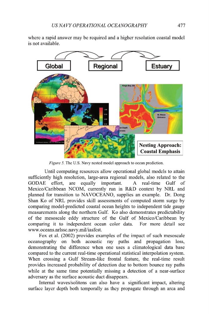
Figure 5. The U.S. Navy nested model approach to ocean prediction.
Until computing resources allow operational global models to attain
sufficiently high resolution, large-area regional models, also related to the
GODAE effort, are equally important.
A real-time Gulf of
Mexico/Caribbean NCOM, currently run in R&D context by NRL and
planned for transition to NAVOCEANO, supplies an example. Dr. Dong
Shan Ko of NRL provides skill assessments of computed storm surge by
comparing model-predicted coastal ocean heights to independent tide gauge
measurements along the northern Gulf. Ko also demonstrates predictability
of the mesoscale eddy structure of the Gulf of Mexico/Caribbean by
comparing it to independent ocean color data. For more detail see
www.oceans.nrlssc.navy.mil/iasfcst.
Fox et al. (2002) provides examples of the impact of such mesoscale
oceanography on both acoustic ray paths and propagation loss,
demonstrating the difference when one uses a climatological data base
compared to the current real-time operational statistical interpolation system.
When crossing a Gulf Stream-like frontal feature, the real-time result
provides increased probability of detection due to bottom bounce ray paths
while at the same time potentially missing a detection of a near-surface
adversary as the surface acoustic duct disappears.
Internal waves/ solitons can also have a significant impact, altering
surface layer depth both temporally as they propagate through an area and
477
where a rapid answer may be required and a higher resolution coastal model
is not available.
Figure 5. The U.S. Navy nested model approach to ocean prediction.
Until computing resources allow operational global models to attain
sufficiently high resolution, large-area regional models, also related to the
GODAE effort, are equally important.
A real-time Gulf of
Mexico/Caribbean NCOM, currently run in R&D context by NRL and
planned for transition to NAVOCEANO, supplies an example. Dr. Dong
Shan Ko of NRL provides skill assessments of computed storm surge by
comparing model-predicted coastal ocean heights to independent tide gauge
measurements along the northern Gulf. Ko also demonstrates predictability
of the mesoscale eddy structure of the Gulf of Mexico/Caribbean by
comparing it to independent ocean color data. For more detail see
www.oceans.nrlssc.navy.mil/iasfcst.
Fox et al. (2002) provides examples of the impact of such mesoscale
oceanography on both acoustic ray paths and propagation loss,
demonstrating the difference when one uses a climatological data base
compared to the current real-time operational statistical interpolation system.
When crossing a Gulf Stream-like frontal feature, the real-time result
provides increased probability of detection due to bottom bounce ray paths
while at the same time potentially missing a detection of a near-surface
adversary as the surface acoustic duct disappears.
Internal waves/ solitons can also have a significant impact, altering
surface layer depth both temporally as they propagate through an area and