

216
SYLVIE POULIQUEN
synergies with the developing US OOI initiative. An important factor in
turning these measurements into an operational system will be the
harmonization, integration, and dissemination of the data collected. This
effort is under way.
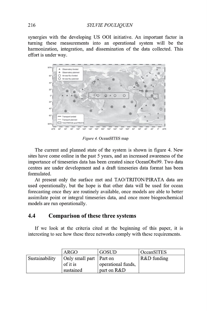
Figure 4. OceanSITES map
The current and planned state of the system is shown in figure 4. New
sites have come online in the past 5 years, and an increased awareness of the
importance of timeseries data has been created since OceanObs99. Two data
centres are under development and a draft timeseries data format has been
formulated.
At present only the surface met and TAO/TRITON/PIRATA data are
used operationally, but the hope is that other data will be used for ocean
forecasting once they are routinely available, once models are able to better
assimilate point or integral timeseries data, and once more biogeochemical
models are run operationally.
4.4
Comparison of these three systems
If we look at the criteria cited at the beginning of this paper, it is
interesting to see how these three networks comply with these requirements.
ARGO
GOSUD
OceanSITES
Sustainability
Only small part
of it is
sustained
Part on
operational funds,
part on R&D
R&D funding
SYLVIE POULIQUEN
synergies with the developing US OOI initiative. An important factor in
turning these measurements into an operational system will be the
harmonization, integration, and dissemination of the data collected. This
effort is under way.
Figure 4. OceanSITES map
The current and planned state of the system is shown in figure 4. New
sites have come online in the past 5 years, and an increased awareness of the
importance of timeseries data has been created since OceanObs99. Two data
centres are under development and a draft timeseries data format has been
formulated.
At present only the surface met and TAO/TRITON/PIRATA data are
used operationally, but the hope is that other data will be used for ocean
forecasting once they are routinely available, once models are able to better
assimilate point or integral timeseries data, and once more biogeochemical
models are run operationally.
4.4
Comparison of these three systems
If we look at the criteria cited at the beginning of this paper, it is
interesting to see how these three networks comply with these requirements.
ARGO
GOSUD
OceanSITES
Sustainability
Only small part
of it is
sustained
Part on
operational funds,
part on R&D
R&D funding