

168
IAN ROBINSON
Instrument
Spatial coverage
and nadir resolution
Time sampling
Accuracy
Polar orbiting IR radiometer (e.g.
AVHRR)
Global; 1.1 km,
12 hr; cloudlimited
0.3 - 0.5 K
Polar orbiting dual view IR
radiometer (e.g. AATSR)
Global; 1 km
Twice in 2-4 days,
cloud-limited
0.1 0.3 K
Polar-orbiting microwave
radiometer (e.g. AMSR-E)
Global;
25 - 50 km
12 hr - 2 days
0.3 - 0.5 K
Geostationary orbit IR sensor
(e.g. SEVIRI on Meteosat S.G.)
50ºS – 50ºN;
2-5 km
30 min, cloudlimited
0.3 - 0.5 K
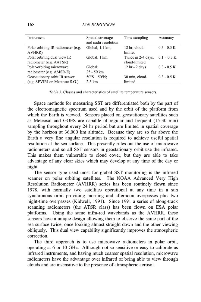
Table 3. Classes and characteristics of satellite temperature sensors.
Space methods for measuring SST are differentiated both by the part of
the electromagnetic spectrum used and by the orbit of the platform from
which the Earth is viewed. Sensors placed on geostationary satellites such
as Meteosat and GOES are capable of regular and frequent (15-30 min)
sampling throughout every 24 hr period but are limited in spatial coverage
by the horizon at 36,000 km altitude. Because they are so far above the
Earth a very fine angular resolution is required to achieve useful spatial
resolution at the sea surface. This presently rules out the use of microwave
radiometers and so all SST sensors in geostationary orbit use the infrared.
This makes them vulnerable to cloud cover, but they are able to take
advantage of any clear skies which may develop at any time of the day or
night.
The sensor type used most for global SST monitoring is the infrared
scanner on polar orbiting satellites. The NOAA Advanced Very High
Resolution Radiometer (AVHRR) series has been routinely flown since
1978, with normally two satellites operational at any time in a sun
synchronous orbit providing morning and afternoon overpasses plus two
night-time overpasses (Kidwell, 1991). Since 1991 a series of along-track
scanning radiometers (the ATSR class) has been flown on ESA polar
platforms. Using the same infra-red wavebands as the AVHRR, these
sensors have a unique design allowing them to observe the same part of the
sea surface twice, once looking almost straight down and the other viewing
obliquely. This dual view capability significantly improves the atmospheric
correction.
The third approach is to use microwave radiometers in polar orbit,
operating at 6 or 10 GHz. Although not so sensitive or easy to calibrate as
infrared instruments, and having much coarser spatial resolution, microwave
radiometers have the advantage over infrared of being able to view through
clouds and are insensitive to the presence of atmospheric aerosol.
-
IAN ROBINSON
Instrument
Spatial coverage
and nadir resolution
Time sampling
Accuracy
Polar orbiting IR radiometer (e.g.
AVHRR)
Global; 1.1 km,
12 hr; cloudlimited
0.3 - 0.5 K
Polar orbiting dual view IR
radiometer (e.g. AATSR)
Global; 1 km
Twice in 2-4 days,
cloud-limited
0.1 0.3 K
Polar-orbiting microwave
radiometer (e.g. AMSR-E)
Global;
25 - 50 km
12 hr - 2 days
0.3 - 0.5 K
Geostationary orbit IR sensor
(e.g. SEVIRI on Meteosat S.G.)
50ºS – 50ºN;
2-5 km
30 min, cloudlimited
0.3 - 0.5 K
Table 3. Classes and characteristics of satellite temperature sensors.
Space methods for measuring SST are differentiated both by the part of
the electromagnetic spectrum used and by the orbit of the platform from
which the Earth is viewed. Sensors placed on geostationary satellites such
as Meteosat and GOES are capable of regular and frequent (15-30 min)
sampling throughout every 24 hr period but are limited in spatial coverage
by the horizon at 36,000 km altitude. Because they are so far above the
Earth a very fine angular resolution is required to achieve useful spatial
resolution at the sea surface. This presently rules out the use of microwave
radiometers and so all SST sensors in geostationary orbit use the infrared.
This makes them vulnerable to cloud cover, but they are able to take
advantage of any clear skies which may develop at any time of the day or
night.
The sensor type used most for global SST monitoring is the infrared
scanner on polar orbiting satellites. The NOAA Advanced Very High
Resolution Radiometer (AVHRR) series has been routinely flown since
1978, with normally two satellites operational at any time in a sun
synchronous orbit providing morning and afternoon overpasses plus two
night-time overpasses (Kidwell, 1991). Since 1991 a series of along-track
scanning radiometers (the ATSR class) has been flown on ESA polar
platforms. Using the same infra-red wavebands as the AVHRR, these
sensors have a unique design allowing them to observe the same part of the
sea surface twice, once looking almost straight down and the other viewing
obliquely. This dual view capability significantly improves the atmospheric
correction.
The third approach is to use microwave radiometers in polar orbit,
operating at 6 or 10 GHz. Although not so sensitive or easy to calibrate as
infrared instruments, and having much coarser spatial resolution, microwave
radiometers have the advantage over infrared of being able to view through
clouds and are insensitive to the presence of atmospheric aerosol.
-