

142
5 3D Level Modelling
as the Deep Western Boundary Current in the Atlantic Ocean. Outflow of dense
water from the Eurafrican Mediterranean Sea finds an equal density horizon at
around 1000-m water depth in the adjacent ocean where it leaves the sea floor
and becomes injected into the ambient water column. This outflow is also popular
for its creation of submerged mesoscale eddies called “meddies” by the scientific
community.
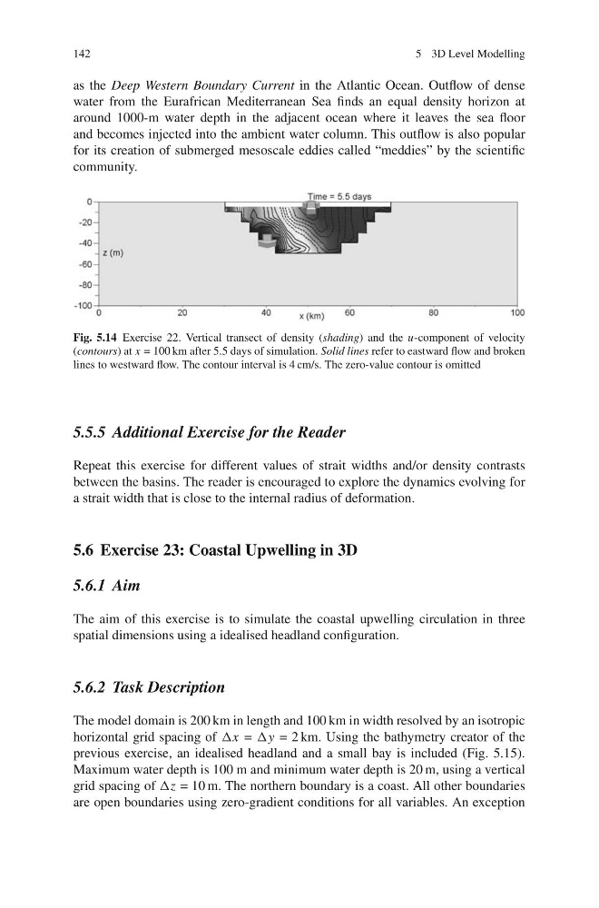
Fig. 5.14 Exercise 22. Vertical transect of density (shading) and the u-component of velocity
(contours) at x = 100 km after 5.5 days of simulation. Solid lines refer to eastward flow and broken
lines to westward flow. The contour interval is 4 cm/s. The zero-value contour is omitted
5.5.5 Additional Exercise for the Reader
Repeat this exercise for different values of strait widths and/or density contrasts
between the basins. The reader is encouraged to explore the dynamics evolving for
a strait width that is close to the internal radius of deformation.
5.6 Exercise 23: Coastal Upwelling in 3D
5.6.1 Aim
The aim of this exercise is to simulate the coastal upwelling circulation in three
spatial dimensions using a idealised headland configuration.
5.6.2 Task Description
The model domain is 200 km in length and 100 km in width resolved by an isotropic
horizontal grid spacing of Δx = Δy = 2 km. Using the bathymetry creator of the
previous exercise, an idealised headland and a small bay is included (Fig. 5.15).
Maximum water depth is 100 m and minimum water depth is 20 m, using a vertical
grid spacing of Δz = 10 m. The northern boundary is a coast. All other boundaries
are open boundaries using zero-gradient conditions for all variables. An exception
5 3D Level Modelling
as the Deep Western Boundary Current in the Atlantic Ocean. Outflow of dense
water from the Eurafrican Mediterranean Sea finds an equal density horizon at
around 1000-m water depth in the adjacent ocean where it leaves the sea floor
and becomes injected into the ambient water column. This outflow is also popular
for its creation of submerged mesoscale eddies called “meddies” by the scientific
community.
Fig. 5.14 Exercise 22. Vertical transect of density (shading) and the u-component of velocity
(contours) at x = 100 km after 5.5 days of simulation. Solid lines refer to eastward flow and broken
lines to westward flow. The contour interval is 4 cm/s. The zero-value contour is omitted
5.5.5 Additional Exercise for the Reader
Repeat this exercise for different values of strait widths and/or density contrasts
between the basins. The reader is encouraged to explore the dynamics evolving for
a strait width that is close to the internal radius of deformation.
5.6 Exercise 23: Coastal Upwelling in 3D
5.6.1 Aim
The aim of this exercise is to simulate the coastal upwelling circulation in three
spatial dimensions using a idealised headland configuration.
5.6.2 Task Description
The model domain is 200 km in length and 100 km in width resolved by an isotropic
horizontal grid spacing of Δx = Δy = 2 km. Using the bathymetry creator of the
previous exercise, an idealised headland and a small bay is included (Fig. 5.15).
Maximum water depth is 100 m and minimum water depth is 20 m, using a vertical
grid spacing of Δz = 10 m. The northern boundary is a coast. All other boundaries
are open boundaries using zero-gradient conditions for all variables. An exception