

echoes that were making noises and yellow spots on the radar screen. Apparently
we were surrounded by hills. We decided to take our first sample and move on to
try to find the deepest area.
The Nautile started to move down a gentle slope on the sedimented bottom. We
reached the deep part of the bottom at 12:11 at a depth of 5052 m. We then arrived
in the deepest part at 5056 m depths, in a small depression at the foot of a northfacing scarp. At 12h24 I had the submersible stop because there were small
(\50 cm high) mounds of black colored Fe–Mn material at the intersection
between the scarp and the sedimented depression. As the Nautile was turning, we
noticed other black colored mounds aligned along the strike of the scarp, which
was oriented East–West (N106° direction). Max stopped the Nautile and used the
manipulating arm on the starboard side to take a small coring tube from the sample
basket, which he then pushed into one of the mounds for sampling the soft looking
material (sample GN01-02).
At 12h30, at a depth of 5054 m, I actually saw the tracks of a sled (dredge),
which had been pulled across the deep ocean sediment. Hard as this was to believe,
it appeared that we had managed to land our submersible in exactly the right place.
The marks, which had remained on the sedimented sea floor, were another proof
that we had come to precisely where we wanted to be. Seeing these traces of the
dredge, which had been pulled on the sea floor 11 years earlier by the R.V.
SONNE, was an incredible experience.
Rock debris, which had slumped down from the scarp and was composed of
serpentinized peridotite, lay on the sedimented floor. When I saw the material
recovered, I was absolutely sure that we were in the right area, the area previously
sampled in 1980 by the R.V. SONNE. The first peridotite mixed with altered
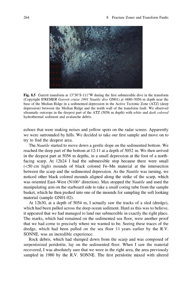
Fig. 8.5 Garrett transform at 13°30’S-111°W during the first submersible dive in the transform
(Copyright IFREMER Garrett cruise 1991 Nautile dive GN01) at 4880–5056 m depth near the
base of the Median Ridge in a sedimented depression in the Active Tectonic Zone (ATZ) (deep
depression) between the Median Ridge and the north wall of the transform fault. We observed
ultramafic outcrops in the deepest part of the ATZ (5056 m depth) with white and dark colored
hydrothermal sediment and avalanche debris
264
8 Fracture Zones and Transform Faults
we were surrounded by hills. We decided to take our first sample and move on to
try to find the deepest area.
The Nautile started to move down a gentle slope on the sedimented bottom. We
reached the deep part of the bottom at 12:11 at a depth of 5052 m. We then arrived
in the deepest part at 5056 m depths, in a small depression at the foot of a northfacing scarp. At 12h24 I had the submersible stop because there were small
(\50 cm high) mounds of black colored Fe–Mn material at the intersection
between the scarp and the sedimented depression. As the Nautile was turning, we
noticed other black colored mounds aligned along the strike of the scarp, which
was oriented East–West (N106° direction). Max stopped the Nautile and used the
manipulating arm on the starboard side to take a small coring tube from the sample
basket, which he then pushed into one of the mounds for sampling the soft looking
material (sample GN01-02).
At 12h30, at a depth of 5054 m, I actually saw the tracks of a sled (dredge),
which had been pulled across the deep ocean sediment. Hard as this was to believe,
it appeared that we had managed to land our submersible in exactly the right place.
The marks, which had remained on the sedimented sea floor, were another proof
that we had come to precisely where we wanted to be. Seeing these traces of the
dredge, which had been pulled on the sea floor 11 years earlier by the R.V.
SONNE, was an incredible experience.
Rock debris, which had slumped down from the scarp and was composed of
serpentinized peridotite, lay on the sedimented floor. When I saw the material
recovered, I was absolutely sure that we were in the right area, the area previously
sampled in 1980 by the R.V. SONNE. The first peridotite mixed with altered
Fig. 8.5 Garrett transform at 13°30’S-111°W during the first submersible dive in the transform
(Copyright IFREMER Garrett cruise 1991 Nautile dive GN01) at 4880–5056 m depth near the
base of the Median Ridge in a sedimented depression in the Active Tectonic Zone (ATZ) (deep
depression) between the Median Ridge and the north wall of the transform fault. We observed
ultramafic outcrops in the deepest part of the ATZ (5056 m depth) with white and dark colored
hydrothermal sediment and avalanche debris
264
8 Fracture Zones and Transform Faults