

9 years earlier near 17°25
0 S on the EPR axis. The exact satellite location where
the engine was lost was communicated to the head of the diving team, Guy
Sciarrone, but the divers could no longer find the SCAMPI. Instead, they saw a
new fresh lava field that covered the depression inside the lava pond, where the
engine had first been first lost and now was buried. Since then, several visual
observations during diving on marked targets have enabled us to determine that the
recurrence of volcanic eruptions on certain ridge segments could be on the order of
weeks or months.
The Pacific–Antarctic Ridge at 36–42°S
The Pacific-Antarctic Ridge (PAR) looks like a continuance of the East Pacific
Rise in the southern hemisphere. It is located between Australia and Antarctica and
it continues up to the southern boundary of the Juan Fernandez Microplate near
35°S-111°W. It extends for about 5,000 km in length.
An area of the PAR was visited during three sea-going expeditions shared
between French, German and American institutes in 1995, 2001 and 2004.
Although, the Pacific-Antarctic Ridge between 35°S and 56°S was previously
surveyed (Lonsdale 1994), it was in 1995 and 1997, during the French-German
cooperative program, that the most detailed work was carried out with the R.V.
SONNE (Leg 100, coordinated by the University of Kiel in Germany) and R.V.
L’ATALANTE. In June-July 2001, the FS SONNE (Leg 157) with the newly
installed SIMRAD EM120 multibeam bathymetry system returned to the area. The
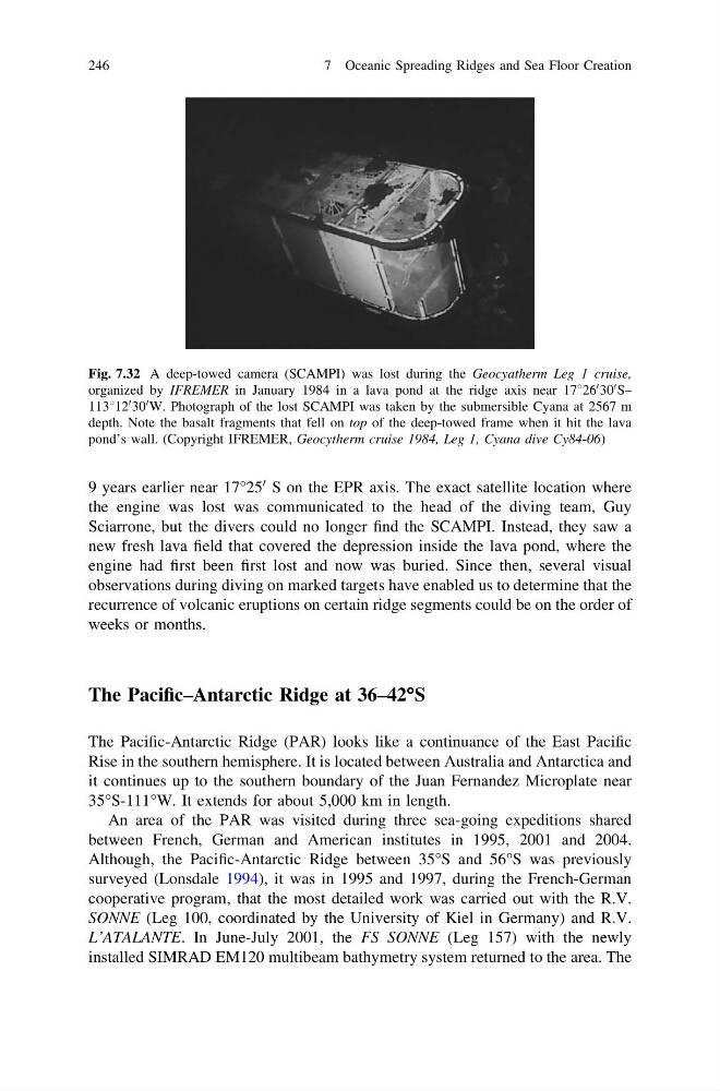
Fig. 7.32 A deep-towed camera (SCAMPI) was lost during the Geocyatherm Leg 1 cruise,
organized by IFREMER in January 1984 in a lava pond at the ridge axis near 17826
0 30
0 S–
113812
0 30
0 W. Photograph of the lost SCAMPI was taken by the submersible Cyana at 2567 m
depth. Note the basalt fragments that fell on top of the deep-towed frame when it hit the lava
pond’s wall. (Copyright IFREMER, Geocytherm cruise 1984, Leg 1, Cyana dive Cy84-06)
246
7 Oceanic Spreading Ridges and Sea Floor Creation
0 S on the EPR axis. The exact satellite location where
the engine was lost was communicated to the head of the diving team, Guy
Sciarrone, but the divers could no longer find the SCAMPI. Instead, they saw a
new fresh lava field that covered the depression inside the lava pond, where the
engine had first been first lost and now was buried. Since then, several visual
observations during diving on marked targets have enabled us to determine that the
recurrence of volcanic eruptions on certain ridge segments could be on the order of
weeks or months.
The Pacific–Antarctic Ridge at 36–42°S
The Pacific-Antarctic Ridge (PAR) looks like a continuance of the East Pacific
Rise in the southern hemisphere. It is located between Australia and Antarctica and
it continues up to the southern boundary of the Juan Fernandez Microplate near
35°S-111°W. It extends for about 5,000 km in length.
An area of the PAR was visited during three sea-going expeditions shared
between French, German and American institutes in 1995, 2001 and 2004.
Although, the Pacific-Antarctic Ridge between 35°S and 56°S was previously
surveyed (Lonsdale 1994), it was in 1995 and 1997, during the French-German
cooperative program, that the most detailed work was carried out with the R.V.
SONNE (Leg 100, coordinated by the University of Kiel in Germany) and R.V.
L’ATALANTE. In June-July 2001, the FS SONNE (Leg 157) with the newly
installed SIMRAD EM120 multibeam bathymetry system returned to the area. The
Fig. 7.32 A deep-towed camera (SCAMPI) was lost during the Geocyatherm Leg 1 cruise,
organized by IFREMER in January 1984 in a lava pond at the ridge axis near 17826
0 30
0 S–
113812
0 30
0 W. Photograph of the lost SCAMPI was taken by the submersible Cyana at 2567 m
depth. Note the basalt fragments that fell on top of the deep-towed frame when it hit the lava
pond’s wall. (Copyright IFREMER, Geocytherm cruise 1984, Leg 1, Cyana dive Cy84-06)
246
7 Oceanic Spreading Ridges and Sea Floor Creation