

The transponders, which had served to make our precise map, were left on the
bottom in order to be used when another mission would return to the site. We
decided to go to the Island of Clipperton, which would also serve to reinforce
French presence in this remote area. In 1986, the fact of our passage on Clipperton
was of help when the French government wanted to construct a meteorological
station in the framework of an international climate study as well as set up a
seismic station on this small Island, in order to monitor earthquakes on the west
coast of Mexico.
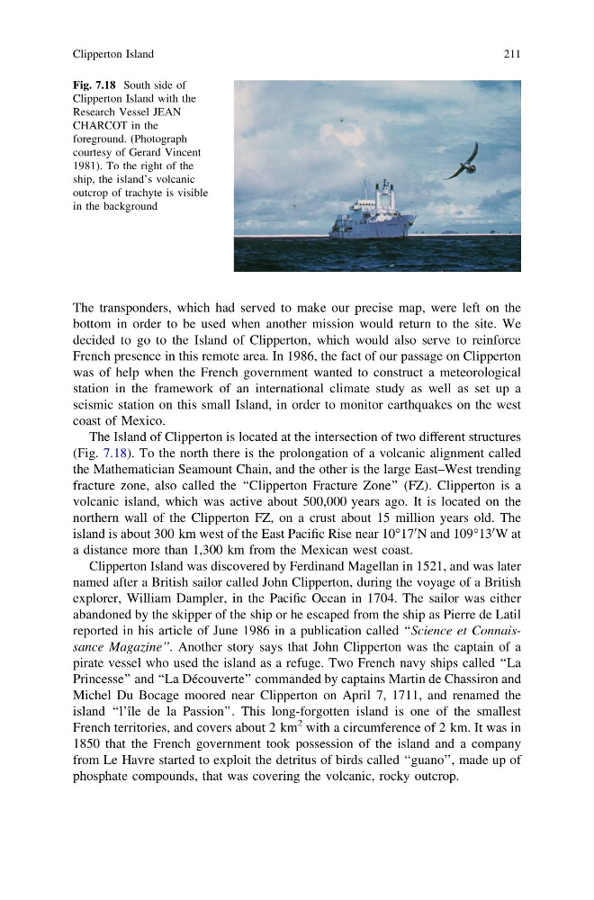
The Island of Clipperton is located at the intersection of two different structures
(Fig. 7.18). To the north there is the prolongation of a volcanic alignment called
the Mathematician Seamount Chain, and the other is the large East–West trending
fracture zone, also called the ‘‘Clipperton Fracture Zone’’ (FZ). Clipperton is a
volcanic island, which was active about 500,000 years ago. It is located on the
northern wall of the Clipperton FZ, on a crust about 15 million years old. The
island is about 300 km west of the East Pacific Rise near 10°17
0 N and 109°13
0 W at
a distance more than 1,300 km from the Mexican west coast.
Clipperton Island was discovered by Ferdinand Magellan in 1521, and was later
named after a British sailor called John Clipperton, during the voyage of a British
explorer, William Dampler, in the Pacific Ocean in 1704. The sailor was either
abandoned by the skipper of the ship or he escaped from the ship as Pierre de Latil
reported in his article of June 1986 in a publication called ‘‘Science et Connaissance Magazine’’. Another story says that John Clipperton was the captain of a
pirate vessel who used the island as a refuge. Two French navy ships called ‘‘La
Princesse’’ and ‘‘La Découverte’’ commanded by captains Martin de Chassiron and
Michel Du Bocage moored near Clipperton on April 7, 1711, and renamed the
island ‘‘l’île de la Passion’’. This long-forgotten island is one of the smallest
French territories, and covers about 2 km
2 with a circumference of 2 km. It was in
1850 that the French government took possession of the island and a company
from Le Havre started to exploit the detritus of birds called ‘‘guano’’, made up of
phosphate compounds, that was covering the volcanic, rocky outcrop.
Fig. 7.18 South side of
Clipperton Island with the
Research Vessel JEAN
CHARCOT in the
foreground. (Photograph
courtesy of Gerard Vincent
1981). To the right of the
ship, the island’s volcanic
outcrop of trachyte is visible
in the background
Clipperton Island
211
bottom in order to be used when another mission would return to the site. We
decided to go to the Island of Clipperton, which would also serve to reinforce
French presence in this remote area. In 1986, the fact of our passage on Clipperton
was of help when the French government wanted to construct a meteorological
station in the framework of an international climate study as well as set up a
seismic station on this small Island, in order to monitor earthquakes on the west
coast of Mexico.
The Island of Clipperton is located at the intersection of two different structures
(Fig. 7.18). To the north there is the prolongation of a volcanic alignment called
the Mathematician Seamount Chain, and the other is the large East–West trending
fracture zone, also called the ‘‘Clipperton Fracture Zone’’ (FZ). Clipperton is a
volcanic island, which was active about 500,000 years ago. It is located on the
northern wall of the Clipperton FZ, on a crust about 15 million years old. The
island is about 300 km west of the East Pacific Rise near 10°17
0 N and 109°13
0 W at
a distance more than 1,300 km from the Mexican west coast.
Clipperton Island was discovered by Ferdinand Magellan in 1521, and was later
named after a British sailor called John Clipperton, during the voyage of a British
explorer, William Dampler, in the Pacific Ocean in 1704. The sailor was either
abandoned by the skipper of the ship or he escaped from the ship as Pierre de Latil
reported in his article of June 1986 in a publication called ‘‘Science et Connaissance Magazine’’. Another story says that John Clipperton was the captain of a
pirate vessel who used the island as a refuge. Two French navy ships called ‘‘La
Princesse’’ and ‘‘La Découverte’’ commanded by captains Martin de Chassiron and
Michel Du Bocage moored near Clipperton on April 7, 1711, and renamed the
island ‘‘l’île de la Passion’’. This long-forgotten island is one of the smallest
French territories, and covers about 2 km
2 with a circumference of 2 km. It was in
1850 that the French government took possession of the island and a company
from Le Havre started to exploit the detritus of birds called ‘‘guano’’, made up of
phosphate compounds, that was covering the volcanic, rocky outcrop.
Fig. 7.18 South side of
Clipperton Island with the
Research Vessel JEAN
CHARCOT in the
foreground. (Photograph
courtesy of Gerard Vincent
1981). To the right of the
ship, the island’s volcanic
outcrop of trachyte is visible
in the background
Clipperton Island
211