

80
R. Romeiser et al.
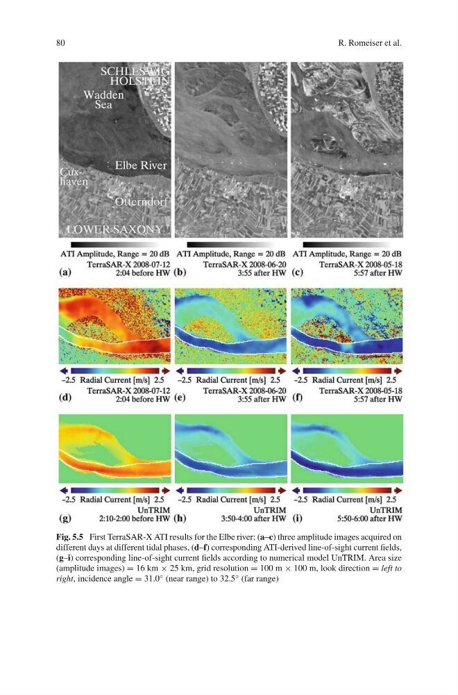
Fig. 5.5 First TerraSAR-X ATI results for the Elbe river; (a–c) three amplitude images acquired on
different days at different tidal phases, (d–f) corresponding ATI-derived line-of-sight current fields,
(g–i) corresponding line-of-sight current fields according to numerical model UnTRIM. Area size
(amplitude images) = 16 km × 25 km, grid resolution = 100 m × 100 m, look direction = left to
right, incidence angle = 31.0 ◦ (near range) to 32.5 ◦ (far range)
R. Romeiser et al.
Fig. 5.5 First TerraSAR-X ATI results for the Elbe river; (a–c) three amplitude images acquired on
different days at different tidal phases, (d–f) corresponding ATI-derived line-of-sight current fields,
(g–i) corresponding line-of-sight current fields according to numerical model UnTRIM. Area size
(amplitude images) = 16 km × 25 km, grid resolution = 100 m × 100 m, look direction = left to
right, incidence angle = 31.0 ◦ (near range) to 32.5 ◦ (far range)