

5 Direct Surface Current Field Imaging from Space
77
5.3 Experimental Results
While the single-antenna Doppler anomaly analysis can be applied to thousands of
existing SAR images from the last 2 decades, the archive of existing spaceborne ATI
images of ocean scenes is limited to a few images from the 11-day SRTM mission
in February 2000 and a few test images that have been acquired with TerraSAR-X
since spring 2008. Here is a summary of key results we have obtained so far.
5.3.1 Along-Track InSAR Results
The single-pass XTI system installed on space shuttle Endeavour for the SRTM
mission in February 2000 had an along-track antenna distance of 7 m (in addition to
the cross-track distance of 60 m, which is not relevant for current measurements),
which permitted current retrievals at a few test sites of opportunity, while the primary mission objective was topographic mapping over land (Rabus et al., 2003).
TerraSAR-X, launched in June 2007, has a programmable phased-array antenna
panel that can be divided into two parts with a theoretical phase center distance of
2.4 m for receiving. In both cases, the effective baseline is half the given distance,
and the effective ATI time lags are clearly suboptimal (see Fig. 5.1), but the data
have been good enough for a demonstration of current measurements from space by
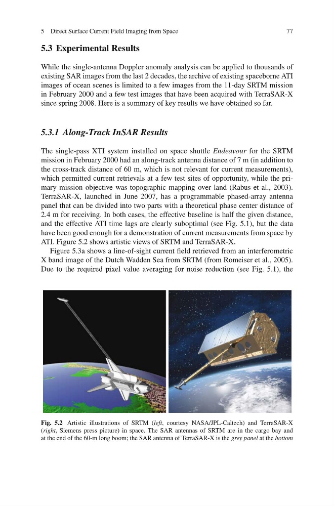
ATI. Figure 5.2 shows artistic views of SRTM and TerraSAR-X.
Figure 5.3a shows a line-of-sight current field retrieved from an interferometric
X band image of the Dutch Wadden Sea from SRTM (from Romeiser et al., 2005).
Due to the required pixel value averaging for noise reduction (see Fig. 5.1), the
Fig. 5.2 Artistic illustrations of SRTM (left, courtesy NASA/JPL-Caltech) and TerraSAR-X
(right, Siemens press picture) in space. The SAR antennas of SRTM are in the cargo bay and
at the end of the 60-m long boom; the SAR antenna of TerraSAR-X is the grey panel at the bottom
77
5.3 Experimental Results
While the single-antenna Doppler anomaly analysis can be applied to thousands of
existing SAR images from the last 2 decades, the archive of existing spaceborne ATI
images of ocean scenes is limited to a few images from the 11-day SRTM mission
in February 2000 and a few test images that have been acquired with TerraSAR-X
since spring 2008. Here is a summary of key results we have obtained so far.
5.3.1 Along-Track InSAR Results
The single-pass XTI system installed on space shuttle Endeavour for the SRTM
mission in February 2000 had an along-track antenna distance of 7 m (in addition to
the cross-track distance of 60 m, which is not relevant for current measurements),
which permitted current retrievals at a few test sites of opportunity, while the primary mission objective was topographic mapping over land (Rabus et al., 2003).
TerraSAR-X, launched in June 2007, has a programmable phased-array antenna
panel that can be divided into two parts with a theoretical phase center distance of
2.4 m for receiving. In both cases, the effective baseline is half the given distance,
and the effective ATI time lags are clearly suboptimal (see Fig. 5.1), but the data
have been good enough for a demonstration of current measurements from space by
ATI. Figure 5.2 shows artistic views of SRTM and TerraSAR-X.
Figure 5.3a shows a line-of-sight current field retrieved from an interferometric
X band image of the Dutch Wadden Sea from SRTM (from Romeiser et al., 2005).
Due to the required pixel value averaging for noise reduction (see Fig. 5.1), the
Fig. 5.2 Artistic illustrations of SRTM (left, courtesy NASA/JPL-Caltech) and TerraSAR-X
(right, Siemens press picture) in space. The SAR antennas of SRTM are in the cargo bay and
at the end of the 60-m long boom; the SAR antenna of TerraSAR-X is the grey panel at the bottom