

68
K.B. Katsaros
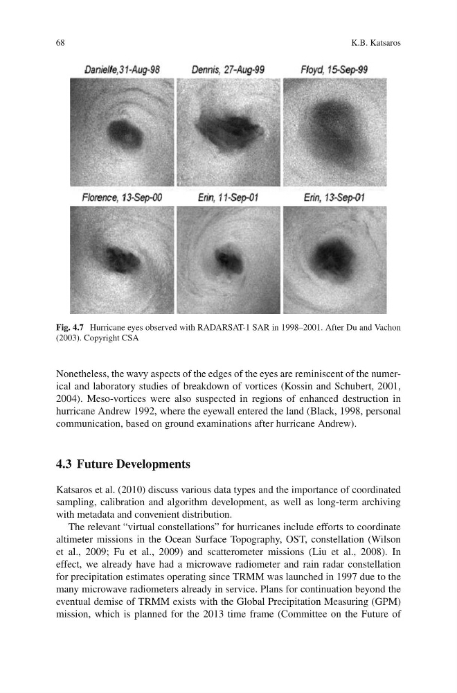
Fig. 4.7 Hurricane eyes observed with RADARSAT-1 SAR in 1998–2001. After Du and Vachon
(2003). Copyright CSA
Nonetheless, the wavy aspects of the edges of the eyes are reminiscent of the numerical and laboratory studies of breakdown of vortices (Kossin and Schubert, 2001,
2004). Meso-vortices were also suspected in regions of enhanced destruction in
hurricane Andrew 1992, where the eyewall entered the land (Black, 1998, personal
communication, based on ground examinations after hurricane Andrew).
4.3 Future Developments
Katsaros et al. (2010) discuss various data types and the importance of coordinated
sampling, calibration and algorithm development, as well as long-term archiving
with metadata and convenient distribution.
The relevant “virtual constellations” for hurricanes include efforts to coordinate
altimeter missions in the Ocean Surface Topography, OST, constellation (Wilson
et al., 2009; Fu et al., 2009) and scatterometer missions (Liu et al., 2008). In
effect, we already have had a microwave radiometer and rain radar constellation
for precipitation estimates operating since TRMM was launched in 1997 due to the
many microwave radiometers already in service. Plans for continuation beyond the
eventual demise of TRMM exists with the Global Precipitation Measuring (GPM)
mission, which is planned for the 2013 time frame (Committee on the Future of
K.B. Katsaros
Fig. 4.7 Hurricane eyes observed with RADARSAT-1 SAR in 1998–2001. After Du and Vachon
(2003). Copyright CSA
Nonetheless, the wavy aspects of the edges of the eyes are reminiscent of the numerical and laboratory studies of breakdown of vortices (Kossin and Schubert, 2001,
2004). Meso-vortices were also suspected in regions of enhanced destruction in
hurricane Andrew 1992, where the eyewall entered the land (Black, 1998, personal
communication, based on ground examinations after hurricane Andrew).
4.3 Future Developments
Katsaros et al. (2010) discuss various data types and the importance of coordinated
sampling, calibration and algorithm development, as well as long-term archiving
with metadata and convenient distribution.
The relevant “virtual constellations” for hurricanes include efforts to coordinate
altimeter missions in the Ocean Surface Topography, OST, constellation (Wilson
et al., 2009; Fu et al., 2009) and scatterometer missions (Liu et al., 2008). In
effect, we already have had a microwave radiometer and rain radar constellation
for precipitation estimates operating since TRMM was launched in 1997 due to the
many microwave radiometers already in service. Plans for continuation beyond the
eventual demise of TRMM exists with the Global Precipitation Measuring (GPM)
mission, which is planned for the 2013 time frame (Committee on the Future of