

62
K.B. Katsaros
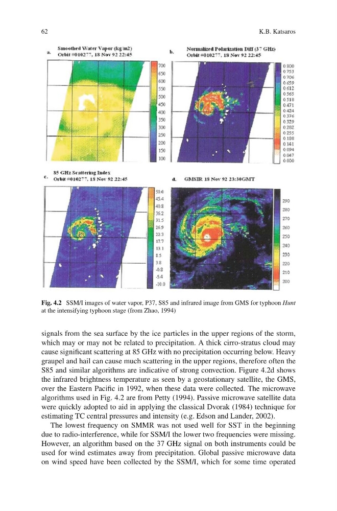
Fig. 4.2 SSM/I images of water vapor, P37, S85 and infrared image from GMS for typhoon Hunt
at the intensifying typhoon stage (from Zhao, 1994)
signals from the sea surface by the ice particles in the upper regions of the storm,
which may or may not be related to precipitation. A thick cirro-stratus cloud may
cause significant scattering at 85 GHz with no precipitation occurring below. Heavy
graupel and hail can cause much scattering in the upper regions, therefore often the
S85 and similar algorithms are indicative of strong convection. Figure 4.2d shows
the infrared brightness temperature as seen by a geostationary satellite, the GMS,
over the Eastern Pacific in 1992, when these data were collected. The microwave
algorithms used in Fig. 4.2 are from Petty (1994). Passive microwave satellite data
were quickly adopted to aid in applying the classical Dvorak (1984) technique for
estimating TC central pressures and intensity (e.g. Edson and Lander, 2002).
The lowest frequency on SMMR was not used well for SST in the beginning
due to radio-interference, while for SSM/I the lower two frequencies were missing.
However, an algorithm based on the 37 GHz signal on both instruments could be
used for wind estimates away from precipitation. Global passive microwave data
on wind speed have been collected by the SSM/I, which for some time operated
K.B. Katsaros
Fig. 4.2 SSM/I images of water vapor, P37, S85 and infrared image from GMS for typhoon Hunt
at the intensifying typhoon stage (from Zhao, 1994)
signals from the sea surface by the ice particles in the upper regions of the storm,
which may or may not be related to precipitation. A thick cirro-stratus cloud may
cause significant scattering at 85 GHz with no precipitation occurring below. Heavy
graupel and hail can cause much scattering in the upper regions, therefore often the
S85 and similar algorithms are indicative of strong convection. Figure 4.2d shows
the infrared brightness temperature as seen by a geostationary satellite, the GMS,
over the Eastern Pacific in 1992, when these data were collected. The microwave
algorithms used in Fig. 4.2 are from Petty (1994). Passive microwave satellite data
were quickly adopted to aid in applying the classical Dvorak (1984) technique for
estimating TC central pressures and intensity (e.g. Edson and Lander, 2002).
The lowest frequency on SMMR was not used well for SST in the beginning
due to radio-interference, while for SSM/I the lower two frequencies were missing.
However, an algorithm based on the 37 GHz signal on both instruments could be
used for wind estimates away from precipitation. Global passive microwave data
on wind speed have been collected by the SSM/I, which for some time operated