

236
P.J. Minnett
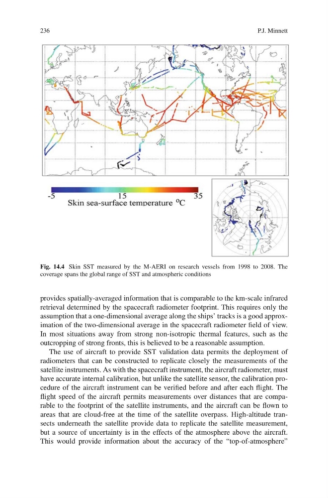
Fig. 14.4 Skin SST measured by the M-AERI on research vessels from 1998 to 2008. The
coverage spans the global range of SST and atmospheric conditions
provides spatially-averaged information that is comparable to the km-scale infrared
retrieval determined by the spacecraft radiometer footprint. This requires only the
assumption that a one-dimensional average along the ships’ tracks is a good approximation of the two-dimensional average in the spacecraft radiometer field of view.
In most situations away from strong non-isotropic thermal features, such as the
outcropping of strong fronts, this is believed to be a reasonable assumption.
The use of aircraft to provide SST validation data permits the deployment of
radiometers that can be constructed to replicate closely the measurements of the
satellite instruments. As with the spacecraft instrument, the aircraft radiometer, must
have accurate internal calibration, but unlike the satellite sensor, the calibration procedure of the aircraft instrument can be verified before and after each flight. The
flight speed of the aircraft permits measurements over distances that are comparable to the footprint of the satellite instruments, and the aircraft can be flown to
areas that are cloud-free at the time of the satellite overpass. High-altitude transects underneath the satellite provide data to replicate the satellite measurement,
but a source of uncertainty is in the effects of the atmosphere above the aircraft.
This would provide information about the accuracy of the “top-of-atmosphere”
P.J. Minnett
Fig. 14.4 Skin SST measured by the M-AERI on research vessels from 1998 to 2008. The
coverage spans the global range of SST and atmospheric conditions
provides spatially-averaged information that is comparable to the km-scale infrared
retrieval determined by the spacecraft radiometer footprint. This requires only the
assumption that a one-dimensional average along the ships’ tracks is a good approximation of the two-dimensional average in the spacecraft radiometer field of view.
In most situations away from strong non-isotropic thermal features, such as the
outcropping of strong fronts, this is believed to be a reasonable assumption.
The use of aircraft to provide SST validation data permits the deployment of
radiometers that can be constructed to replicate closely the measurements of the
satellite instruments. As with the spacecraft instrument, the aircraft radiometer, must
have accurate internal calibration, but unlike the satellite sensor, the calibration procedure of the aircraft instrument can be verified before and after each flight. The
flight speed of the aircraft permits measurements over distances that are comparable to the footprint of the satellite instruments, and the aircraft can be flown to
areas that are cloud-free at the time of the satellite overpass. High-altitude transects underneath the satellite provide data to replicate the satellite measurement,
but a source of uncertainty is in the effects of the atmosphere above the aircraft.
This would provide information about the accuracy of the “top-of-atmosphere”