

7 Interpretation of SAR Signatures of the Sea Surface
127
Timor (south), Arafura (southeast), and Ceram and Molucca (north) seas. The Banda
Sea is a part of the Indonesian Throughflow (ITF), which is an important pathway
for the transfer of western tropical Pacific waters into the southeastern Indian Ocean
through the Indonesian seas. Within the Banda Sea, Pacific waters are modified by
the joint action of various physical processes and then exit into the Indian Ocean via
the Timor Strait or the Ombai Strait. SAR and visible images allowed to conclude
that IWs were very likely generated by a sill between Alor and Atauro Islands in the
Ombai Strait, one of the major passages of ITF (Mitnik and Dubina, 2009.
Figure 7.11 shows two packets of IWs propagating northward into the Banda
Sea. The IWs have the classic appearance of rank ordered non-linear waves that
depress the pycnocline (Atlas of Internal Solitary-like Waves, 2004; Apel, 2004).
IWs were clearly seen within the whole Envisat swath (405 km). The crests of solitons form almost correct semicircles, limited by the islands. The length of several
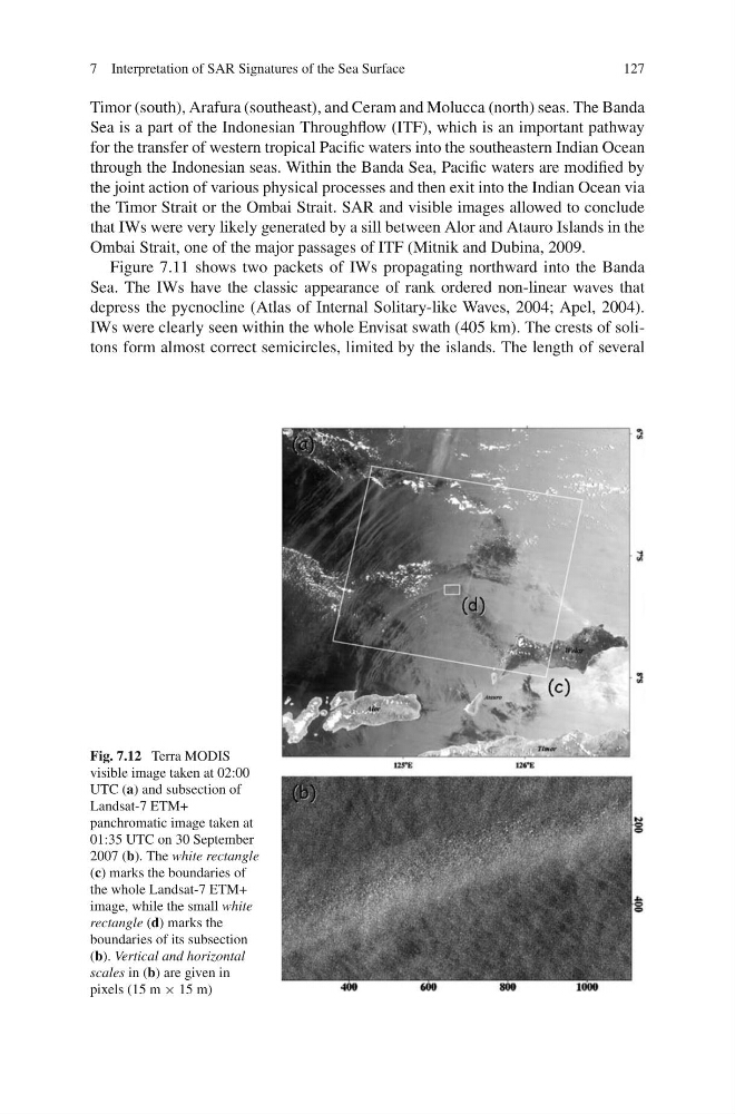
Fig. 7.12 Terra MODIS
visible image taken at 02:00
UTC (a) and subsection of
Landsat-7 ETM+
panchromatic image taken at
01:35 UTC on 30 September
2007 (b). The white rectangle
(c) marks the boundaries of
the whole Landsat-7 ETM+
image, while the small white
rectangle (d) marks the
boundaries of its subsection
(b). Vertical and horizontal
scales in (b) are given in
pixels (15 m × 15 m)
127
Timor (south), Arafura (southeast), and Ceram and Molucca (north) seas. The Banda
Sea is a part of the Indonesian Throughflow (ITF), which is an important pathway
for the transfer of western tropical Pacific waters into the southeastern Indian Ocean
through the Indonesian seas. Within the Banda Sea, Pacific waters are modified by
the joint action of various physical processes and then exit into the Indian Ocean via
the Timor Strait or the Ombai Strait. SAR and visible images allowed to conclude
that IWs were very likely generated by a sill between Alor and Atauro Islands in the
Ombai Strait, one of the major passages of ITF (Mitnik and Dubina, 2009.
Figure 7.11 shows two packets of IWs propagating northward into the Banda
Sea. The IWs have the classic appearance of rank ordered non-linear waves that
depress the pycnocline (Atlas of Internal Solitary-like Waves, 2004; Apel, 2004).
IWs were clearly seen within the whole Envisat swath (405 km). The crests of solitons form almost correct semicircles, limited by the islands. The length of several
Fig. 7.12 Terra MODIS
visible image taken at 02:00
UTC (a) and subsection of
Landsat-7 ETM+
panchromatic image taken at
01:35 UTC on 30 September
2007 (b). The white rectangle
(c) marks the boundaries of
the whole Landsat-7 ETM+
image, while the small white
rectangle (d) marks the
boundaries of its subsection
(b). Vertical and horizontal
scales in (b) are given in
pixels (15 m × 15 m)