

The GMT Methodology
Geopotential models may be tested using many types
of gravimetric observations. Consistent with the
theories of Molodensky, the GMT methodology
compares "observed" gravity potentials to model
gravity potentials at the Earth's surface. Two alternate
methods are presented for determining the "observed"
gravity potential at the surface. The first method uses
normal heights and the parameters of the level
ellipsoid. The second method uses geopotential
numbers and the geoidal potential. The results
presented in this paper are based on the first method.
The second method is presented as a basis for future
investigations.
Normal Height Method. The normal height variation
of the GMT methodology is based on the definition of
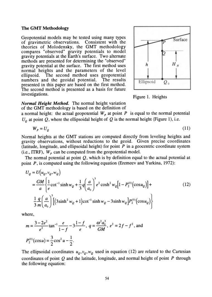
h
Figure 1. Heights
a normal height: the actual geopotential W p at point P is equal to the normal potential
U Q at point Q, where the ellipsoidal height of Q is the normal height (Figure 1), i.e.
(11)
Normal heights at the GMT stations are computed directly from leveling heights and
gravity observations, without reductions to the geoid. Given precise coordinates
(latitude, longitude, and ellipsoidal height) for point P in a geocentric coordinate system
(i.e., ITRF), Wp can be computed from the geopotential model.
The normal potential at point Q, which is by definition equal to the actual potential at
point P, is computed using the following equation (Eremeev and Yurkina, 1972):
U Q = U(uQ,vQ,w Q )
= GM {!COC1 sinh w Q + !q(!!...)3 e 2 cosh2 w Q [ 1- pJO) ( cosu Q )] +
a e
3 a o
!!L(!!...)3 [(3sinh2 w Q + 1 )cot- I sinh w Q - 3sinh w Q ]p~O)( COSU Q )}
3m a o
where,
3 - 2e
2
-I
e
3 1- f
m
2
ag 2 2/ /2
d
m = e2 tan 1 _ / - -e _. ,q = GM ,e = - , an
3
1
p~O)(cosu) = -cos 2 U --.
2
2
(12)
The ellipsoidal coordinates u Q ' v Q ' w Q used in equation (12) are related to the Cartesian
coordinates of point Q and the latitude, longitude, and normal height of point P through
the following equation:
54
Geopotential models may be tested using many types
of gravimetric observations. Consistent with the
theories of Molodensky, the GMT methodology
compares "observed" gravity potentials to model
gravity potentials at the Earth's surface. Two alternate
methods are presented for determining the "observed"
gravity potential at the surface. The first method uses
normal heights and the parameters of the level
ellipsoid. The second method uses geopotential
numbers and the geoidal potential. The results
presented in this paper are based on the first method.
The second method is presented as a basis for future
investigations.
Normal Height Method. The normal height variation
of the GMT methodology is based on the definition of
h
Figure 1. Heights
a normal height: the actual geopotential W p at point P is equal to the normal potential
U Q at point Q, where the ellipsoidal height of Q is the normal height (Figure 1), i.e.
(11)
Normal heights at the GMT stations are computed directly from leveling heights and
gravity observations, without reductions to the geoid. Given precise coordinates
(latitude, longitude, and ellipsoidal height) for point P in a geocentric coordinate system
(i.e., ITRF), Wp can be computed from the geopotential model.
The normal potential at point Q, which is by definition equal to the actual potential at
point P, is computed using the following equation (Eremeev and Yurkina, 1972):
U Q = U(uQ,vQ,w Q )
= GM {!COC1 sinh w Q + !q(!!...)3 e 2 cosh2 w Q [ 1- pJO) ( cosu Q )] +
a e
3 a o
!!L(!!...)3 [(3sinh2 w Q + 1 )cot- I sinh w Q - 3sinh w Q ]p~O)( COSU Q )}
3m a o
where,
3 - 2e
2
-I
e
3 1- f
m
2
ag 2 2/ /2
d
m = e2 tan 1 _ / - -e _. ,q = GM ,e = - , an
3
1
p~O)(cosu) = -cos 2 U --.
2
2
(12)
The ellipsoidal coordinates u Q ' v Q ' w Q used in equation (12) are related to the Cartesian
coordinates of point Q and the latitude, longitude, and normal height of point P through
the following equation:
54