

Some global grids of satellite altimeter derived gravity for the oceans were just being
produced, e.g. Haxby (1985). These were a great advance, but used rather coarse
altimeter data at that time, which could not map the continental margins in great detail.
The continents were still poorly mapped.
Two main uses of large scale compiled gravity data could be envisaged.
1. Geological modelling. Oil companies were becoming increasingly aware of the value
of large scale gravity data sets for regional geological mapping and the ability to view
local features in a wider context.
2. Geoid calculation. The availability of large scale, high resolution gravity data enables
much more accurate geoids to be derived over large areas.
Thus the African Gravity Project (AGP) was started by GETECH in 1986, followed by
the South American Gravity Project (SAGP), the West-East Europe Gravity Project
(WEEGP) , the South East Asia Gravity Project and the North Central Asia Gravity
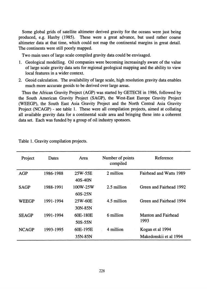
Project (NCAGP) - see table 1. These were all compilation projects, aimed at collating
all available gravity data for a continental scale area and bringing these into a coherent
data set. Each was funded by a group of oil industry sponsors.
Table 1. Gravity compilation projects.
Project
Dates
Area
Number of points
Reference
compiled
AGP
1986-1988
25W-55E
2 million
Fairhead and Watts 1989
40S-40N
SAGP
1988-1991
l00W-25W
2.5 million
Green and Fairhead 1992
60S-25N
WEEGP
1991-1994
25W-60E
4.5 million
Green and Fairhead 1994
30N-85N
SEAGP
1991-1994
60E-180E
6 million
Manton and Fairhead
50S-55N
1993
NCAGP
1993-1995
60E-195E
\
4 million
Kogan et al 1994
35N-85N
Makedonskii et al 1994
228
produced, e.g. Haxby (1985). These were a great advance, but used rather coarse
altimeter data at that time, which could not map the continental margins in great detail.
The continents were still poorly mapped.
Two main uses of large scale compiled gravity data could be envisaged.
1. Geological modelling. Oil companies were becoming increasingly aware of the value
of large scale gravity data sets for regional geological mapping and the ability to view
local features in a wider context.
2. Geoid calculation. The availability of large scale, high resolution gravity data enables
much more accurate geoids to be derived over large areas.
Thus the African Gravity Project (AGP) was started by GETECH in 1986, followed by
the South American Gravity Project (SAGP), the West-East Europe Gravity Project
(WEEGP) , the South East Asia Gravity Project and the North Central Asia Gravity
Project (NCAGP) - see table 1. These were all compilation projects, aimed at collating
all available gravity data for a continental scale area and bringing these into a coherent
data set. Each was funded by a group of oil industry sponsors.
Table 1. Gravity compilation projects.
Project
Dates
Area
Number of points
Reference
compiled
AGP
1986-1988
25W-55E
2 million
Fairhead and Watts 1989
40S-40N
SAGP
1988-1991
l00W-25W
2.5 million
Green and Fairhead 1992
60S-25N
WEEGP
1991-1994
25W-60E
4.5 million
Green and Fairhead 1994
30N-85N
SEAGP
1991-1994
60E-180E
6 million
Manton and Fairhead
50S-55N
1993
NCAGP
1993-1995
60E-195E
\
4 million
Kogan et al 1994
35N-85N
Makedonskii et al 1994
228