

690
Land-Ocean Systems in the Siberian Arctic: Dvnamics and History
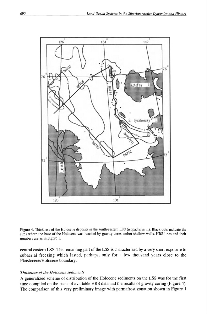
Figure 4. Thickness of the Holocene deposits in the south-eastern LSS (isopachs in m). Black dots indicate the
sites where the base of the Holocene was reached by gravity cores and/or shallow wells. HRS lines and their
numbers are as in Figure I.
central eastern LSS. The remaining part of the LSS is characterized by a very short exposure to
subaerial freezing which lasted, perhaps, only for a few thousand years close to the
PleistocenelHolocene boundary.
Thickness pfthe Holocene sediments
A generalized scheme of distribution of the Holocene sediments on the LSS was for the first
time compiled on the basis of available HRS data and the results of gravity coring (Figure 4).
The comparison of this very preliminary image with permafrost zonation shown in Figure 1
Land-Ocean Systems in the Siberian Arctic: Dvnamics and History
Figure 4. Thickness of the Holocene deposits in the south-eastern LSS (isopachs in m). Black dots indicate the
sites where the base of the Holocene was reached by gravity cores and/or shallow wells. HRS lines and their
numbers are as in Figure I.
central eastern LSS. The remaining part of the LSS is characterized by a very short exposure to
subaerial freezing which lasted, perhaps, only for a few thousand years close to the
PleistocenelHolocene boundary.
Thickness pfthe Holocene sediments
A generalized scheme of distribution of the Holocene sediments on the LSS was for the first
time compiled on the basis of available HRS data and the results of gravity coring (Figure 4).
The comparison of this very preliminary image with permafrost zonation shown in Figure 1