

588
Land-Ocean Systems in the Siberian Arctic: Dynamics and History
Dethleff et aI., 1993). As a result of the steep increase in river run-off with beginning river ice
breakup in May followed by the gradual melting of the Laptev Sea ice cover, a large brackish
surface plume extending up to 350 km northward covers large parts of the Laptev Sea during
the short summer period (Letolle et aI., 1993).
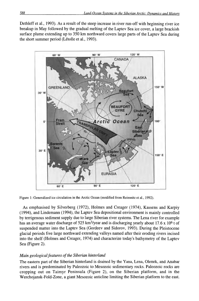
Figure 1: Generalized ice circulation in the Arctic Ocean (modified from Reimnitz et aI., 1992).
As emphasised by Silverberg (1972), Holmes and Creager (1974), Kassens and Karpiy
(1994), and Lindemann (1994), the Laptev Sea depositional environment is mainly controlled
by terrigenous sediment supply due to large Siberian river systems. The Lena river for example
has an average water discharge of 525 km3/year and is discharging yearly about 17.6 x 10⁶ t of
suspended matter into the Laptev Sea (Gordeev and Sidorov, 1993). During the Pleistocene
glacial periods five large northward extending valleys named after their eroding rivers incised
into the shelf (Holmes and Creager, 1974) and characterize today's bathymetry of the Laptev
Sea (Figure 2).
Main geological features of the Siberian hinterland
The eastern part of the Siberian hinterland is drained by the Yana, Lena, Olenek, and Anabar
rivers and is predominated by Paleozoic to Mesozoic sedimentary rocks. Paleozoic rocks are
cropping out on Taimyr Peninsula (Figure 2), on the Siberian platform, and in the
Werchojansk-Fold-Zone, a giant Mesozoic anticline limiting the Siberian platform to the east.
Land-Ocean Systems in the Siberian Arctic: Dynamics and History
Dethleff et aI., 1993). As a result of the steep increase in river run-off with beginning river ice
breakup in May followed by the gradual melting of the Laptev Sea ice cover, a large brackish
surface plume extending up to 350 km northward covers large parts of the Laptev Sea during
the short summer period (Letolle et aI., 1993).
Figure 1: Generalized ice circulation in the Arctic Ocean (modified from Reimnitz et aI., 1992).
As emphasised by Silverberg (1972), Holmes and Creager (1974), Kassens and Karpiy
(1994), and Lindemann (1994), the Laptev Sea depositional environment is mainly controlled
by terrigenous sediment supply due to large Siberian river systems. The Lena river for example
has an average water discharge of 525 km3/year and is discharging yearly about 17.6 x 10⁶ t of
suspended matter into the Laptev Sea (Gordeev and Sidorov, 1993). During the Pleistocene
glacial periods five large northward extending valleys named after their eroding rivers incised
into the shelf (Holmes and Creager, 1974) and characterize today's bathymetry of the Laptev
Sea (Figure 2).
Main geological features of the Siberian hinterland
The eastern part of the Siberian hinterland is drained by the Yana, Lena, Olenek, and Anabar
rivers and is predominated by Paleozoic to Mesozoic sedimentary rocks. Paleozoic rocks are
cropping out on Taimyr Peninsula (Figure 2), on the Siberian platform, and in the
Werchojansk-Fold-Zone, a giant Mesozoic anticline limiting the Siberian platform to the east.