

534
Land-Ocean Systems in the Siberian Arctic: Dynamics and History
and oceanographic conditions of the surface waters. In several studies the distribution of
diatoms in surface sediments has been related to oceanographic parameters of the overlying
water masses (e.g. Maynard, 1976; Williams, 1986; Koy Karpuz and Schrader, 1990;
Zielinski, 1993).
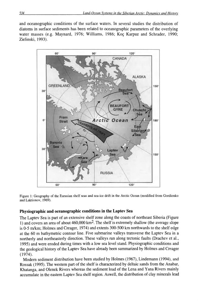
Figure 1: Geography of the Eurasian shelf seas and sea-ice drift in the Arctic Ocean (modified from Gordienko
and Laktionov, 1969).
Physiographic and oceanographic conditions in the Laptev Sea
The Laptev Sea is part of an extensive shelf zone along the coasts of northeast Siberia (Figure
1) and covers an area of about 460,000 km 2 . The shelf is extremely shallow (the average slope
is 0-5 mlkm; Holmes and Creager, 1974) and extents 300-500 km northwards to the shelf edge
at the 60 m bathymetric contour line. Five submarine valleys transverse the Laptev Sea in a
northerly and northeasterly direction. These valleys run along tectonic faults (Drachev et aI.,
1995) and were eroded during times with a low sea level stand. Physiographic conditions and
the geological history of the Laptev Sea have already been summarized by Holmes and Creager
(1974).
Modem sediment distribution have been studied by Holmes (1967), Lindemann (1994), and
Rossak (1995). The western part of the shelf is characterized by deltaic sands from the Anabar,
Khatanga, and Olenek Rivers whereas the sediment load of the Lena and Yana Rivers mainly
accumulate in the eastern Laptev Sea shelf region. AsweIl, the distribution of clay minerals lead
Land-Ocean Systems in the Siberian Arctic: Dynamics and History
and oceanographic conditions of the surface waters. In several studies the distribution of
diatoms in surface sediments has been related to oceanographic parameters of the overlying
water masses (e.g. Maynard, 1976; Williams, 1986; Koy Karpuz and Schrader, 1990;
Zielinski, 1993).
Figure 1: Geography of the Eurasian shelf seas and sea-ice drift in the Arctic Ocean (modified from Gordienko
and Laktionov, 1969).
Physiographic and oceanographic conditions in the Laptev Sea
The Laptev Sea is part of an extensive shelf zone along the coasts of northeast Siberia (Figure
1) and covers an area of about 460,000 km 2 . The shelf is extremely shallow (the average slope
is 0-5 mlkm; Holmes and Creager, 1974) and extents 300-500 km northwards to the shelf edge
at the 60 m bathymetric contour line. Five submarine valleys transverse the Laptev Sea in a
northerly and northeasterly direction. These valleys run along tectonic faults (Drachev et aI.,
1995) and were eroded during times with a low sea level stand. Physiographic conditions and
the geological history of the Laptev Sea have already been summarized by Holmes and Creager
(1974).
Modem sediment distribution have been studied by Holmes (1967), Lindemann (1994), and
Rossak (1995). The western part of the shelf is characterized by deltaic sands from the Anabar,
Khatanga, and Olenek Rivers whereas the sediment load of the Lena and Yana Rivers mainly
accumulate in the eastern Laptev Sea shelf region. AsweIl, the distribution of clay minerals lead