

Pitu17w: Archaeological Survey in Central Taymyr
459
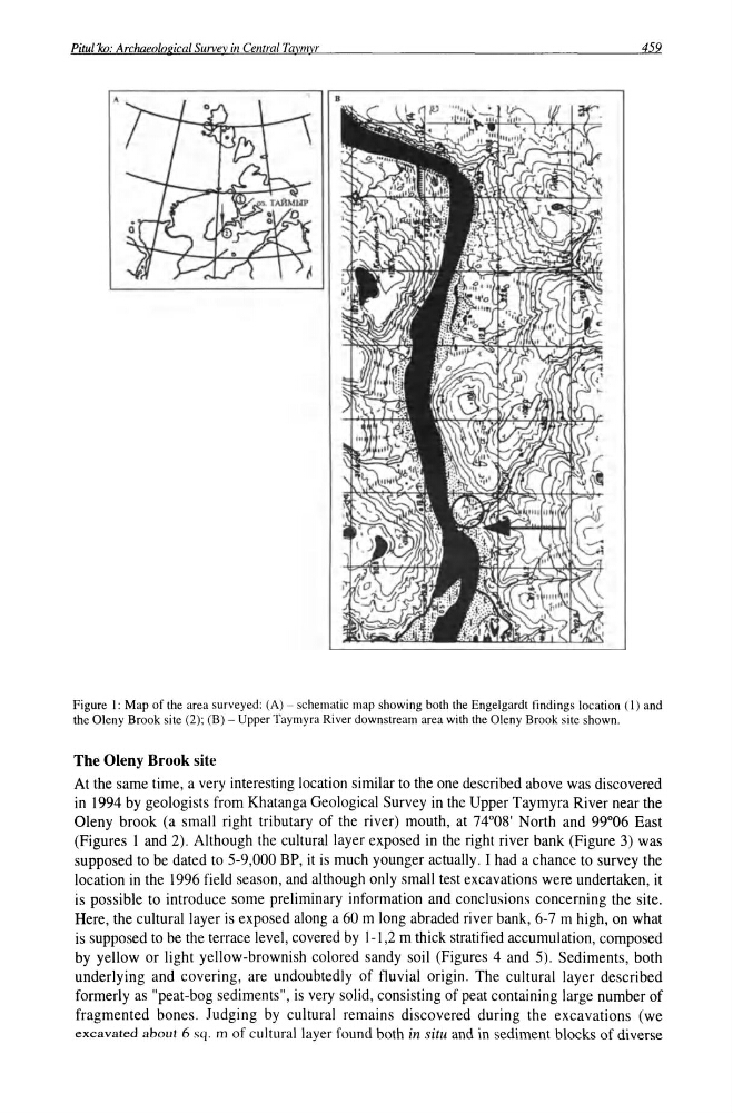
Figure I: Map of the area surveyed: CA) - schematic map showing both the Engelgardt findings location (1) and
the Oleny Brook site (2); (B) - Upper Taymyra River downstream area with the Oleny Brook site shown.
The Oleny Brook site
At the same time, a very interesting location similar to the one described above was discovered
in 1994 by geologists from Khatanga Geological Survey in the Upper Taymyra River near the
Oleny brook (a small right tributary of the river) mouth, at 74°08' North and 99°06 East
(Figures 1 and 2). Although the cultural layer exposed in the right river bank (Figure 3) was
supposed to be dated to 5-9,000 BP, it is much younger actually. I had a chance to survey the
location in the 1996 field season, and although only small test excavations were undertaken, it
is possible to introduce some preliminary information and conclusions concerning the site.
Here, the cultural layer is exposed along a 60 m long abraded river bank, 6-7 m high, on what
is supposed to be the terrace level, covered by 1-1,2 m thick stratified accumulation, composed
by yellow or light yellow-brownish colored sandy soil (Figures 4 and 5). Sediments, both
underlying and covering, are undoubtedly of fluvial origin. The cultural layer described
formerly as "peat-bog sediments", is very solid, consisting of peat containing large number of
fragmented bones. Judging by cultural remains discovered during the excavations (we
excavated about 6 sq. m of cultural layer found both in situ and in sediment blocks of diverse
459
Figure I: Map of the area surveyed: CA) - schematic map showing both the Engelgardt findings location (1) and
the Oleny Brook site (2); (B) - Upper Taymyra River downstream area with the Oleny Brook site shown.
The Oleny Brook site
At the same time, a very interesting location similar to the one described above was discovered
in 1994 by geologists from Khatanga Geological Survey in the Upper Taymyra River near the
Oleny brook (a small right tributary of the river) mouth, at 74°08' North and 99°06 East
(Figures 1 and 2). Although the cultural layer exposed in the right river bank (Figure 3) was
supposed to be dated to 5-9,000 BP, it is much younger actually. I had a chance to survey the
location in the 1996 field season, and although only small test excavations were undertaken, it
is possible to introduce some preliminary information and conclusions concerning the site.
Here, the cultural layer is exposed along a 60 m long abraded river bank, 6-7 m high, on what
is supposed to be the terrace level, covered by 1-1,2 m thick stratified accumulation, composed
by yellow or light yellow-brownish colored sandy soil (Figures 4 and 5). Sediments, both
underlying and covering, are undoubtedly of fluvial origin. The cultural layer described
formerly as "peat-bog sediments", is very solid, consisting of peat containing large number of
fragmented bones. Judging by cultural remains discovered during the excavations (we
excavated about 6 sq. m of cultural layer found both in situ and in sediment blocks of diverse