

Raclwld: Major. Trace and Rare Earth Element Geochemistry
[2J
t555l
D
im
- §
~
, , ,
, ,
Lena basin
ana basin
.50 106 km2 drainage area
25 km3 °a-1 water discharge
10 106 toa-1 sediment supply
.240 106 km2 drainage area
1 km3 oa- 1 water discharge
0106 toa-1 sediment supply
A
SIBERIAN
PLATFORM
crystalline and metamorphic
BAIKAL AND
carbonate
B MONGOLO-OKHOTSK
FOLDED REGION
terrigenic
C
VERKHOYANO-KOL YMEAN
carbonate-terrigenic
FOLDED REGION
0
OKHOTSK-CHUKOTSKI
terrigenic-carbonate
VOLCANOGEN IC BELT
volcanogenic and terrigenic
E ANABAR SHIELD
effusive and intrusive
F SIBERIAN TRAP
201
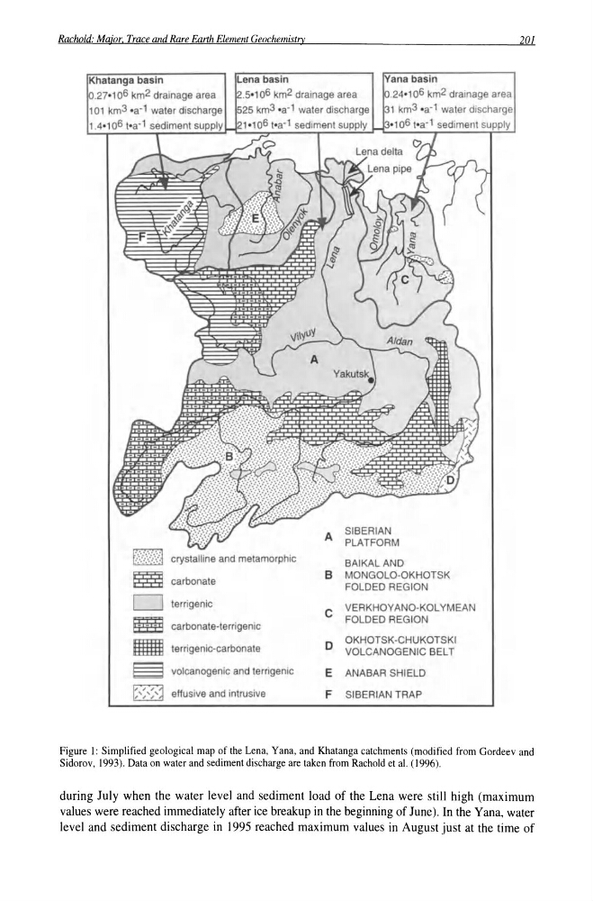
Figure I: Simplified geological map of the Lena. Yana, and Khatanga catchments (modified from Gordeev and
Sidorov, 1993). Data on water and sediment discharge are taken from Rachold et al. (1996).
during July when the water level and sediment load of the Lena were still high (maximum
values were reached immediately after ice breakup in the beginning of June). In the Yana, water
level and sediment discharge in 1995 reached maximum values in August just at the time of
[2J
t555l
D
im
- §
~
, , ,
, ,
Lena basin
ana basin
.50 106 km2 drainage area
25 km3 °a-1 water discharge
10 106 toa-1 sediment supply
.240 106 km2 drainage area
1 km3 oa- 1 water discharge
0106 toa-1 sediment supply
A
SIBERIAN
PLATFORM
crystalline and metamorphic
BAIKAL AND
carbonate
B MONGOLO-OKHOTSK
FOLDED REGION
terrigenic
C
VERKHOYANO-KOL YMEAN
carbonate-terrigenic
FOLDED REGION
0
OKHOTSK-CHUKOTSKI
terrigenic-carbonate
VOLCANOGEN IC BELT
volcanogenic and terrigenic
E ANABAR SHIELD
effusive and intrusive
F SIBERIAN TRAP
201
Figure I: Simplified geological map of the Lena. Yana, and Khatanga catchments (modified from Gordeev and
Sidorov, 1993). Data on water and sediment discharge are taken from Rachold et al. (1996).
during July when the water level and sediment load of the Lena were still high (maximum
values were reached immediately after ice breakup in the beginning of June). In the Yana, water
level and sediment discharge in 1995 reached maximum values in August just at the time of