

Scientific analyses are applied to the samples (cores
with interstitial waters) obtained by wire line coring and
downhole measurements made by logging tools. Longterm borehole observatories are established in some cases
to obtain time series records. These data and samples are
used to describe and understand the Earth’s history, structure, and processes that shaped the present-day Earth system and to predict its future from a wide spectrum of
disciplines of marine geo-biosciences.
The framework for conducting scientific ocean drilling
was established in 1968 and in 1975 became an international scientific program with participating member countries and consortia from the Americas, Asia, Europe, and
Oceania to support the operations of drilling vessels and
science to be conducted on board. Scientists interested in
obtaining samples and data from boreholes in world
oceans submit proposals for eventual drilling expeditions
or request samples from archives to be evaluated by peer
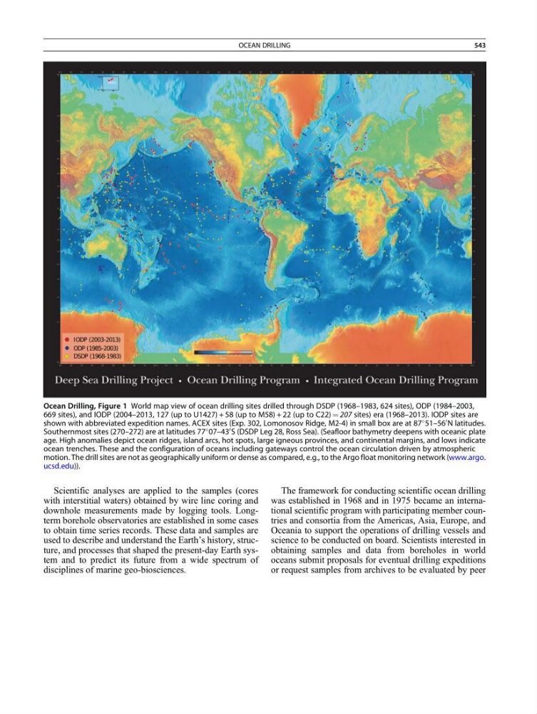
Ocean Drilling, Figure 1 World map view of ocean drilling sites drilled through DSDP (1968–1983, 624 sites), ODP (1984–2003,
669 sites), and IODP (2004–2013, 127 (up to U1427) + 58 (up to M58) + 22 (up to C22) ¼ 207 sites) era (1968–2013). IODP sites are
shown with abbreviated expedition names. ACEX sites (Exp. 302, Lomonosov Ridge, M2-4) in small box are at 87
51–56
0 N latitudes.
Southernmost sites (270–272) are at latitudes 77
07–43
0 S (DSDP Leg 28, Ross Sea). (Seafloor bathymetry deepens with oceanic plate
age. High anomalies depict ocean ridges, island arcs, hot spots, large igneous provinces, and continental margins, and lows indicate
ocean trenches. These and the configuration of oceans including gateways control the ocean circulation driven by atmospheric
motion. The drill sites are not as geographically uniform or dense as compared, e.g., to the Argo float monitoring network (www.argo.
ucsd.edu)).
OCEAN DRILLING
543