

6 The Gulf of Finland
193
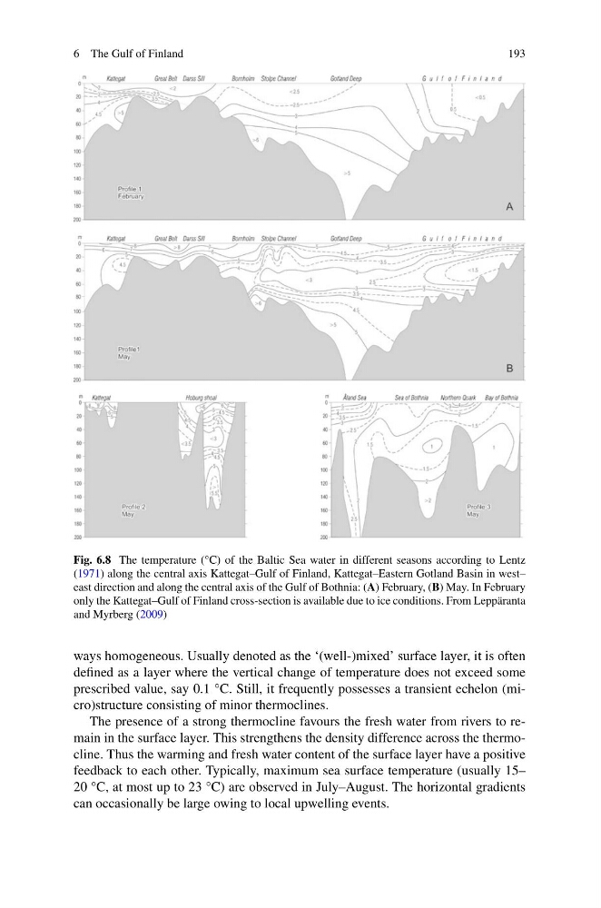
Fig. 6.8 The temperature (°C) of the Baltic Sea water in different seasons according to Lentz
(1971) along the central axis Kattegat–Gulf of Finland, Kattegat–Eastern Gotland Basin in west–
east direction and along the central axis of the Gulf of Bothnia: (A) February, (B) May. In February
only the Kattegat–Gulf of Finland cross-section is available due to ice conditions. From Leppäranta
and Myrberg (2009)
ways homogeneous. Usually denoted as the ‘(well-)mixed’ surface layer, it is often
defined as a layer where the vertical change of temperature does not exceed some
prescribed value, say 0.1 °C. Still, it frequently possesses a transient echelon (micro)structure consisting of minor thermoclines.
The presence of a strong thermocline favours the fresh water from rivers to remain in the surface layer. This strengthens the density difference across the thermocline. Thus the warming and fresh water content of the surface layer have a positive
feedback to each other. Typically, maximum sea surface temperature (usually 15–
20 °C, at most up to 23 °C) are observed in July–August. The horizontal gradients
can occasionally be large owing to local upwelling events.
193
Fig. 6.8 The temperature (°C) of the Baltic Sea water in different seasons according to Lentz
(1971) along the central axis Kattegat–Gulf of Finland, Kattegat–Eastern Gotland Basin in west–
east direction and along the central axis of the Gulf of Bothnia: (A) February, (B) May. In February
only the Kattegat–Gulf of Finland cross-section is available due to ice conditions. From Leppäranta
and Myrberg (2009)
ways homogeneous. Usually denoted as the ‘(well-)mixed’ surface layer, it is often
defined as a layer where the vertical change of temperature does not exceed some
prescribed value, say 0.1 °C. Still, it frequently possesses a transient echelon (micro)structure consisting of minor thermoclines.
The presence of a strong thermocline favours the fresh water from rivers to remain in the surface layer. This strengthens the density difference across the thermocline. Thus the warming and fresh water content of the surface layer have a positive
feedback to each other. Typically, maximum sea surface temperature (usually 15–
20 °C, at most up to 23 °C) are observed in July–August. The horizontal gradients
can occasionally be large owing to local upwelling events.