

5 European Semi-enclosed Seas
145
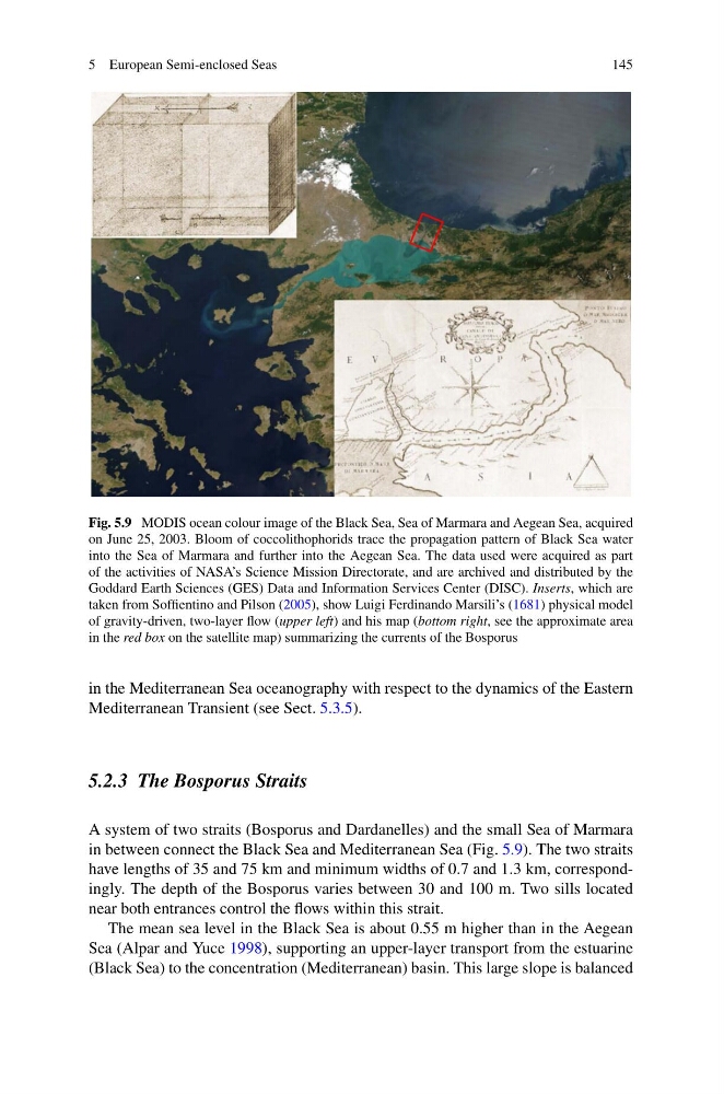
Fig. 5.9 MODIS ocean colour image of the Black Sea, Sea of Marmara and Aegean Sea, acquired
on June 25, 2003. Bloom of coccolithophorids trace the propagation pattern of Black Sea water
into the Sea of Marmara and further into the Aegean Sea. The data used were acquired as part
of the activities of NASA’s Science Mission Directorate, and are archived and distributed by the
Goddard Earth Sciences (GES) Data and Information Services Center (DISC). Inserts, which are
taken from Soffientino and Pilson (2005), show Luigi Ferdinando Marsili’s (1681) physical model
of gravity-driven, two-layer flow (upper left) and his map (bottom right, see the approximate area
in the red box on the satellite map) summarizing the currents of the Bosporus
in the Mediterranean Sea oceanography with respect to the dynamics of the Eastern
Mediterranean Transient (see Sect. 5.3.5).
5.2.3 The Bosporus Straits
A system of two straits (Bosporus and Dardanelles) and the small Sea of Marmara
in between connect the Black Sea and Mediterranean Sea (Fig. 5.9). The two straits
have lengths of 35 and 75 km and minimum widths of 0.7 and 1.3 km, correspondingly. The depth of the Bosporus varies between 30 and 100 m. Two sills located
near both entrances control the flows within this strait.
The mean sea level in the Black Sea is about 0.55 m higher than in the Aegean
Sea (Alpar and Yuce 1998), supporting an upper-layer transport from the estuarine
(Black Sea) to the concentration (Mediterranean) basin. This large slope is balanced
145
Fig. 5.9 MODIS ocean colour image of the Black Sea, Sea of Marmara and Aegean Sea, acquired
on June 25, 2003. Bloom of coccolithophorids trace the propagation pattern of Black Sea water
into the Sea of Marmara and further into the Aegean Sea. The data used were acquired as part
of the activities of NASA’s Science Mission Directorate, and are archived and distributed by the
Goddard Earth Sciences (GES) Data and Information Services Center (DISC). Inserts, which are
taken from Soffientino and Pilson (2005), show Luigi Ferdinando Marsili’s (1681) physical model
of gravity-driven, two-layer flow (upper left) and his map (bottom right, see the approximate area
in the red box on the satellite map) summarizing the currents of the Bosporus
in the Mediterranean Sea oceanography with respect to the dynamics of the Eastern
Mediterranean Transient (see Sect. 5.3.5).
5.2.3 The Bosporus Straits
A system of two straits (Bosporus and Dardanelles) and the small Sea of Marmara
in between connect the Black Sea and Mediterranean Sea (Fig. 5.9). The two straits
have lengths of 35 and 75 km and minimum widths of 0.7 and 1.3 km, correspondingly. The depth of the Bosporus varies between 30 and 100 m. Two sills located
near both entrances control the flows within this strait.
The mean sea level in the Black Sea is about 0.55 m higher than in the Aegean
Sea (Alpar and Yuce 1998), supporting an upper-layer transport from the estuarine
(Black Sea) to the concentration (Mediterranean) basin. This large slope is balanced