

"
, ,
".
,"
J.E. Conde . G. Rodriguez
N
. --c,.,:-- - - + - -t- go
"J
J
SCALE
o 25 50
I
I
I
KILOMETERS
INTERIIATIOMAL BOUNDARY
LIIiITS OF THE BASIN
~~~~~=====~..L70
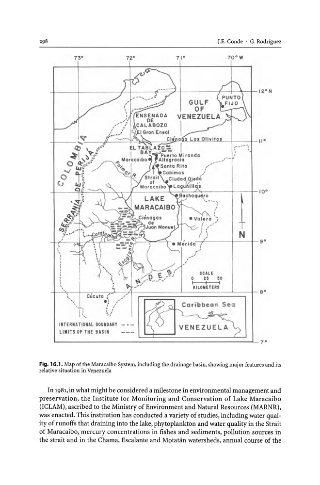
Fig. 16.1. Map of the Maracaibo System, including the drainage basin, showing major features and its
relative situation in Venezuela
In 1981, in what might be considered a milestone in environmental management and
preservation, the Institute for Monitoring and Conservation of Lake Maracaibo
(ICLAM), ascribed to the Ministry of Environment and Natural Resources (MARNR),
was enacted. This institution has conducted a variety of studies, including water quality of runoffs that draining into the lake, phytoplankton and water quality in the Strait
of Maracaibo, mercury concentrations in fishes and sediments, pollution sources in
the strait and in the Chama, Escalante and MQtatan watersheds, annual course of the
, ,
".
,"
J.E. Conde . G. Rodriguez
N
. --c,.,:-- - - + - -t- go
"J
J
SCALE
o 25 50
I
I
I
KILOMETERS
INTERIIATIOMAL BOUNDARY
LIIiITS OF THE BASIN
~~~~~=====~..L70
Fig. 16.1. Map of the Maracaibo System, including the drainage basin, showing major features and its
relative situation in Venezuela
In 1981, in what might be considered a milestone in environmental management and
preservation, the Institute for Monitoring and Conservation of Lake Maracaibo
(ICLAM), ascribed to the Ministry of Environment and Natural Resources (MARNR),
was enacted. This institution has conducted a variety of studies, including water quality of runoffs that draining into the lake, phytoplankton and water quality in the Strait
of Maracaibo, mercury concentrations in fishes and sediments, pollution sources in
the strait and in the Chama, Escalante and MQtatan watersheds, annual course of the