

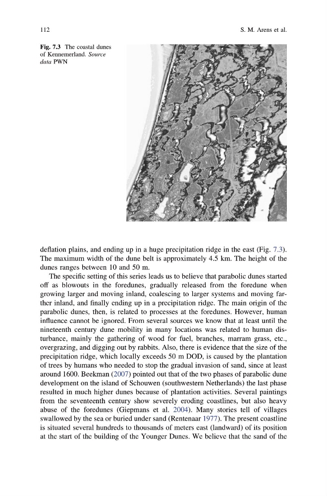
deflation plains, and ending up in a huge precipitation ridge in the east (Fig. 7.3).
The maximum width of the dune belt is approximately 4.5 km. The height of the
dunes ranges between 10 and 50 m.
The specific setting of this series leads us to believe that parabolic dunes started
off as blowouts in the foredunes, gradually released from the foredune when
growing larger and moving inland, coalescing to larger systems and moving farther inland, and finally ending up in a precipitation ridge. The main origin of the
parabolic dunes, then, is related to processes at the foredunes. However, human
influence cannot be ignored. From several sources we know that at least until the
nineteenth century dune mobility in many locations was related to human disturbance, mainly the gathering of wood for fuel, branches, marram grass, etc.,
overgrazing, and digging out by rabbits. Also, there is evidence that the size of the
precipitation ridge, which locally exceeds 50 m DOD, is caused by the plantation
of trees by humans who needed to stop the gradual invasion of sand, since at least
around 1600. Beekman (2007) pointed out that of the two phases of parabolic dune
development on the island of Schouwen (southwestern Netherlands) the last phase
resulted in much higher dunes because of plantation activities. Several paintings
from the seventeenth century show severely eroding coastlines, but also heavy
abuse of the foredunes (Giepmans et al. 2004). Many stories tell of villages
swallowed by the sea or buried under sand (Rentenaar 1977). The present coastline
is situated several hundreds to thousands of meters east (landward) of its position
at the start of the building of the Younger Dunes. We believe that the sand of the
Fig. 7.3 The coastal dunes
of Kennemerland. Source
data PWN
112
S. M. Arens et al.
The maximum width of the dune belt is approximately 4.5 km. The height of the
dunes ranges between 10 and 50 m.
The specific setting of this series leads us to believe that parabolic dunes started
off as blowouts in the foredunes, gradually released from the foredune when
growing larger and moving inland, coalescing to larger systems and moving farther inland, and finally ending up in a precipitation ridge. The main origin of the
parabolic dunes, then, is related to processes at the foredunes. However, human
influence cannot be ignored. From several sources we know that at least until the
nineteenth century dune mobility in many locations was related to human disturbance, mainly the gathering of wood for fuel, branches, marram grass, etc.,
overgrazing, and digging out by rabbits. Also, there is evidence that the size of the
precipitation ridge, which locally exceeds 50 m DOD, is caused by the plantation
of trees by humans who needed to stop the gradual invasion of sand, since at least
around 1600. Beekman (2007) pointed out that of the two phases of parabolic dune
development on the island of Schouwen (southwestern Netherlands) the last phase
resulted in much higher dunes because of plantation activities. Several paintings
from the seventeenth century show severely eroding coastlines, but also heavy
abuse of the foredunes (Giepmans et al. 2004). Many stories tell of villages
swallowed by the sea or buried under sand (Rentenaar 1977). The present coastline
is situated several hundreds to thousands of meters east (landward) of its position
at the start of the building of the Younger Dunes. We believe that the sand of the
Fig. 7.3 The coastal dunes
of Kennemerland. Source
data PWN
112
S. M. Arens et al.