

5.4 Estuaries in the Southern North Sea Region
109
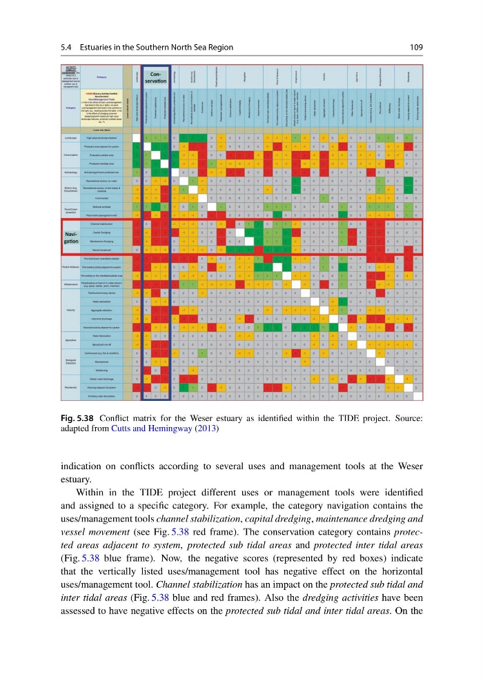
Fig. 5.38 Conflict matrix for the Weser estuary as identified within the TIDE project. Source:
adapted from Cutts and Hemingway (2013)
indication on conflicts according to several uses and management tools at the Weser
estuary.
Within in the TIDE project different uses or management tools were identified
and assigned to a specific category. For example, the category navigation contains the
uses/management tools channel stabilization, capital dredging, maintenance dredging and
vessel movement (see Fig. 5.38 red frame). The conservation category contains protected areas adjacent to system, protected sub tidal areas and protected inter tidal areas
(Fig. 5.38 blue frame). Now, the negative scores (represented by red boxes) indicate
that the vertically listed uses/management tool has negative effect on the horizontal
uses/management tool. Channel stabilization has an impact on the protected sub tidal and
inter tidal areas (Fig. 5.38 blue and red frames). Also the dredging activities have been
assessed to have negative effects on the protected sub tidal and inter tidal areas. On the
109
Fig. 5.38 Conflict matrix for the Weser estuary as identified within the TIDE project. Source:
adapted from Cutts and Hemingway (2013)
indication on conflicts according to several uses and management tools at the Weser
estuary.
Within in the TIDE project different uses or management tools were identified
and assigned to a specific category. For example, the category navigation contains the
uses/management tools channel stabilization, capital dredging, maintenance dredging and
vessel movement (see Fig. 5.38 red frame). The conservation category contains protected areas adjacent to system, protected sub tidal areas and protected inter tidal areas
(Fig. 5.38 blue frame). Now, the negative scores (represented by red boxes) indicate
that the vertically listed uses/management tool has negative effect on the horizontal
uses/management tool. Channel stabilization has an impact on the protected sub tidal and
inter tidal areas (Fig. 5.38 blue and red frames). Also the dredging activities have been
assessed to have negative effects on the protected sub tidal and inter tidal areas. On the