

Morphology and Flow in Streams
63
In the Field
1. Locate a section of a stream for study.
2. Make a sketch map ofthe principal berms (flat levels of the bank) along the chosen section of
stream. This operation can be done with an alidade and plane table (see Exercise 1) or
roughly approximated by careful mesurement of the stream banks with a measuring tape and
meter stick.
3. Measure three cross-sectional areas in this section of the stream. Compare rime and pool
areas. Depth measurements should be made at meter intervals across the channel. Width
measurements should include the two principal berms, when present. Calculate the crosssectional area of the channel based on the current water level, lowest berm, and the highest
berm.
4. Compute the average depth of water and channel for upper and lower berms for each crosssection.
5. Determine at least three current velocity profiles across the stream channel for each of the
three cross-sections. Compare rime and pool areas.
6. Use a float to estimate surface velocity by measuring the time for its passage over a measured
distance (50 to 100 m). Be certain that the float does not become lodged in a back eddy or
behind an obstruction. Repeat this estimate five times and determine the standard error of
the mean (see Appendix 2 for this estimate).
7. Calculate the discharge for all three cross sections based on present water level and the lower
and upper berm levels. These data will provide estimates of the discharge at bankful stage
(Bfs).
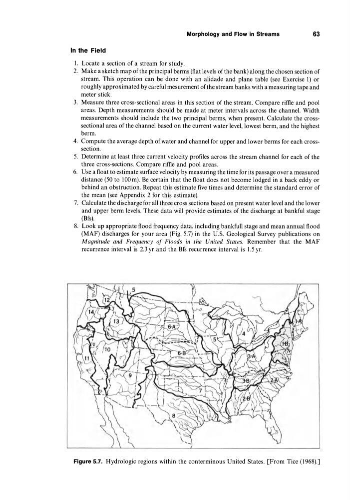
8. Look up appropriate flood frequency data, including bankfull stage and mean annual flood
(MAF) discharges for your area (Fig. 5.7) in the U.S. Geological Survey publications on
Magnitude and Frequency of Floods in the United States. Remember that the MAF
recurrence interval is 2.3 yr and the Bfs recurrence interval is 1.5 yr.
Figure 5.7. Hydrologic regions within the conterminous United States. [From Tice (1968).]
63
In the Field
1. Locate a section of a stream for study.
2. Make a sketch map ofthe principal berms (flat levels of the bank) along the chosen section of
stream. This operation can be done with an alidade and plane table (see Exercise 1) or
roughly approximated by careful mesurement of the stream banks with a measuring tape and
meter stick.
3. Measure three cross-sectional areas in this section of the stream. Compare rime and pool
areas. Depth measurements should be made at meter intervals across the channel. Width
measurements should include the two principal berms, when present. Calculate the crosssectional area of the channel based on the current water level, lowest berm, and the highest
berm.
4. Compute the average depth of water and channel for upper and lower berms for each crosssection.
5. Determine at least three current velocity profiles across the stream channel for each of the
three cross-sections. Compare rime and pool areas.
6. Use a float to estimate surface velocity by measuring the time for its passage over a measured
distance (50 to 100 m). Be certain that the float does not become lodged in a back eddy or
behind an obstruction. Repeat this estimate five times and determine the standard error of
the mean (see Appendix 2 for this estimate).
7. Calculate the discharge for all three cross sections based on present water level and the lower
and upper berm levels. These data will provide estimates of the discharge at bankful stage
(Bfs).
8. Look up appropriate flood frequency data, including bankfull stage and mean annual flood
(MAF) discharges for your area (Fig. 5.7) in the U.S. Geological Survey publications on
Magnitude and Frequency of Floods in the United States. Remember that the MAF
recurrence interval is 2.3 yr and the Bfs recurrence interval is 1.5 yr.
Figure 5.7. Hydrologic regions within the conterminous United States. [From Tice (1968).]