

428
A.H. Schumann and G.A. Schultz
6°
25 00
Sub-catchments of the
Sauer Basin
1: Nims/A lsdorf
2: A"um'A"umzurlay
3: Our/GelTiind
4: Sauer/Michelau
H55 50
50°
H 55 00
49°30'
5: AttertiColma r-Berg
6: Atzette/Ettelbruck
7: Sauer/Boliendorf
8: Sa uer/Miindung
5°30'
R25 00
6°
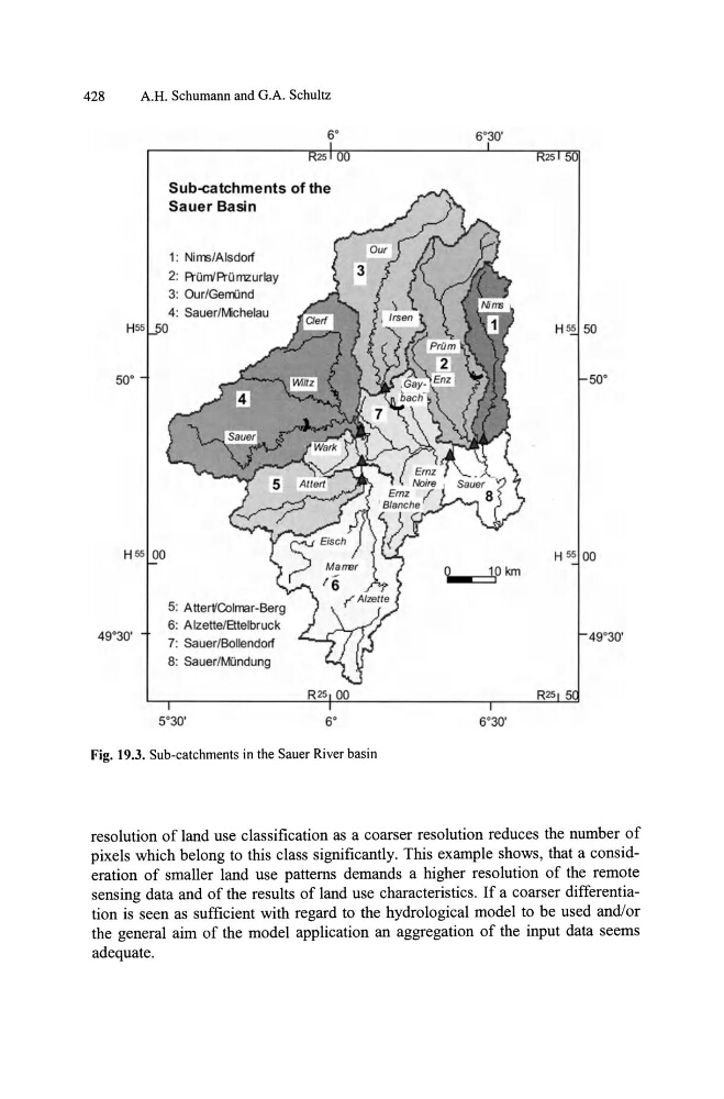
Fig. 19.3. Sub-catchments in the Sauer River basin
6°30'
R 25 50
H 55 50
50 °
H 55 00
~Okm
49°30'
6°30'
resolution of land use classification as a coarser resolution reduces the number of
pixels which belong to this class significantly. This example shows, that a consideration of smaller land use patterns demands a higher resolution of the remote
sensing data and of the results of land use characteristics. If a coarser differentiation is seen as sufficient with regard to the hydrological model to be used and/or
the general aim of the model application an aggregation of the input data seems
adequate.
A.H. Schumann and G.A. Schultz
6°
25 00
Sub-catchments of the
Sauer Basin
1: Nims/A lsdorf
2: A"um'A"umzurlay
3: Our/GelTiind
4: Sauer/Michelau
H55 50
50°
H 55 00
49°30'
5: AttertiColma r-Berg
6: Atzette/Ettelbruck
7: Sauer/Boliendorf
8: Sa uer/Miindung
5°30'
R25 00
6°
Fig. 19.3. Sub-catchments in the Sauer River basin
6°30'
R 25 50
H 55 50
50 °
H 55 00
~Okm
49°30'
6°30'
resolution of land use classification as a coarser resolution reduces the number of
pixels which belong to this class significantly. This example shows, that a consideration of smaller land use patterns demands a higher resolution of the remote
sensing data and of the results of land use characteristics. If a coarser differentiation is seen as sufficient with regard to the hydrological model to be used and/or
the general aim of the model application an aggregation of the input data seems
adequate.