

8 Evaporation
159
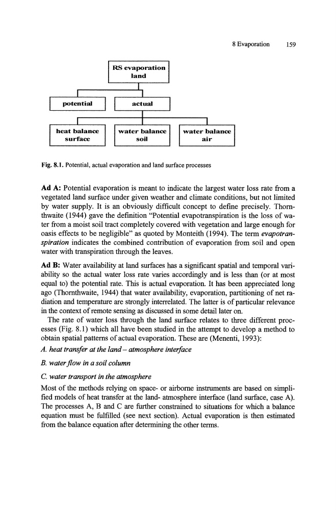
Fig. 8.1. Potential, actual evaporation and land surface processes
Ad A: Potential evaporation is meant to indicate the largest water loss rate from a
vegetated land surface under given weather and climate conditions, but not limited
by water supply. It is an obviously difficult concept to defme precisely. Thornthwaite (1944) gave the definition "Potential evapotranspiration is the loss of water from a moist soil tract completely covered with vegetation and large enough for
oasis effects to be negligible" as quoted by Monteith (1994). The term evapotranspiration indicates the combined contribution of evaporation from soil and open
water with transpiration through the leaves.
Ad B: Water availability at land surfaces has a significant spatial and temporal variability so the actual water loss rate varies accordingly and is less than (or at most
equal to) the potential rate. This is actual evaporation. It has been appreciated long
ago (Thornthwaite, 1944) that water availability, evaporation, partitioning of net radiation and temperature are strongly interrelated. The latter is of particular relevance
in the context of remote sensing as discussed in some detail later on.
The rate of water loss through the land surface relates to three different processes (Fig. 8.1) which all have been studied in the attempt to develop a method to
obtain spatial patterns of actual evaporation. These are (Menenti, 1993):
A. heat transfer at the land - atmosphere interface
B. water flow in a soil column
C. water transport in the atmosphere
Most of the methods relying on space- or airborne instruments are based on simplified models of heat transfer at the land- atmosphere interface (land surface, case A).
The processes A, B and C are further constrained to situations for which a balance
equation must be fulfilled (see next section). Actual evaporation is then estimated
from the balance equation after determining the other terms.
159
Fig. 8.1. Potential, actual evaporation and land surface processes
Ad A: Potential evaporation is meant to indicate the largest water loss rate from a
vegetated land surface under given weather and climate conditions, but not limited
by water supply. It is an obviously difficult concept to defme precisely. Thornthwaite (1944) gave the definition "Potential evapotranspiration is the loss of water from a moist soil tract completely covered with vegetation and large enough for
oasis effects to be negligible" as quoted by Monteith (1994). The term evapotranspiration indicates the combined contribution of evaporation from soil and open
water with transpiration through the leaves.
Ad B: Water availability at land surfaces has a significant spatial and temporal variability so the actual water loss rate varies accordingly and is less than (or at most
equal to) the potential rate. This is actual evaporation. It has been appreciated long
ago (Thornthwaite, 1944) that water availability, evaporation, partitioning of net radiation and temperature are strongly interrelated. The latter is of particular relevance
in the context of remote sensing as discussed in some detail later on.
The rate of water loss through the land surface relates to three different processes (Fig. 8.1) which all have been studied in the attempt to develop a method to
obtain spatial patterns of actual evaporation. These are (Menenti, 1993):
A. heat transfer at the land - atmosphere interface
B. water flow in a soil column
C. water transport in the atmosphere
Most of the methods relying on space- or airborne instruments are based on simplified models of heat transfer at the land- atmosphere interface (land surface, case A).
The processes A, B and C are further constrained to situations for which a balance
equation must be fulfilled (see next section). Actual evaporation is then estimated
from the balance equation after determining the other terms.