

7 Land-use and Catchment Characteristics
139
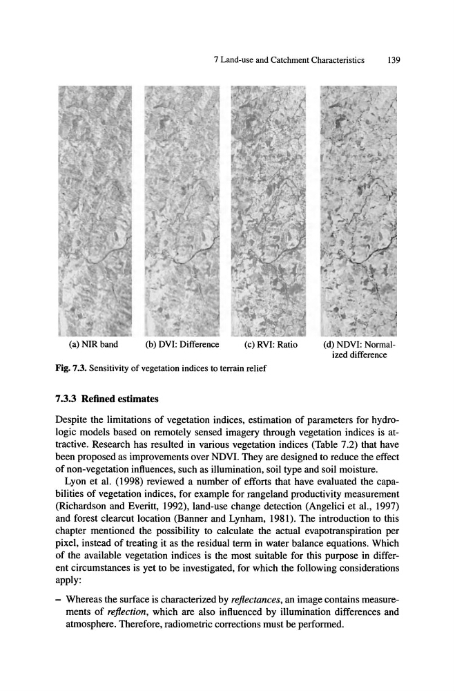
(a) NIR band
(b) DVI: Difference
(c) RVI: Ratio
Fig. 7.3. Sensitivity of vegetation indices to terrain relief
7.3.3 Refined estimates
(d) NDVI: Normalized difference
Despite the limitations of vegetation indices, estimation of parameters for hydrologic models based on remotely sensed imagery through vegetation indices is attractive. Research has resulted in various vegetation indices (Table 7.2) that have
been proposed as improvements over NDVI. They are designed to reduce the effect
of non-vegetation influences, such as illumination, soil type and soil moisture.
Lyon et al. (1998) reviewed a number of efforts that have evaluated the capabilities of vegetation indices, for example for rangeland productivity measurement
(Richardson and Everitt, 1992), land-use change detection (Angelici et aI., 1997)
and forest c1earcut location (Banner and Lynham, 1981). The introduction to this
chapter mentioned the possibility to calculate the actual evapotranspiration per
pixel, instead of treating it as the residual term in water balance equations. Which
of the available vegetation indices is the most suitable for this purpose in different circumstances is yet to be investigated, for which the following considerations
apply:
- Whereas the surface is characterized by reflectances, an image contains measurements of reflection, which are also influenced by illumination differences and
atmosphere. Therefore, radiometric corrections must be performed.
139
(a) NIR band
(b) DVI: Difference
(c) RVI: Ratio
Fig. 7.3. Sensitivity of vegetation indices to terrain relief
7.3.3 Refined estimates
(d) NDVI: Normalized difference
Despite the limitations of vegetation indices, estimation of parameters for hydrologic models based on remotely sensed imagery through vegetation indices is attractive. Research has resulted in various vegetation indices (Table 7.2) that have
been proposed as improvements over NDVI. They are designed to reduce the effect
of non-vegetation influences, such as illumination, soil type and soil moisture.
Lyon et al. (1998) reviewed a number of efforts that have evaluated the capabilities of vegetation indices, for example for rangeland productivity measurement
(Richardson and Everitt, 1992), land-use change detection (Angelici et aI., 1997)
and forest c1earcut location (Banner and Lynham, 1981). The introduction to this
chapter mentioned the possibility to calculate the actual evapotranspiration per
pixel, instead of treating it as the residual term in water balance equations. Which
of the available vegetation indices is the most suitable for this purpose in different circumstances is yet to be investigated, for which the following considerations
apply:
- Whereas the surface is characterized by reflectances, an image contains measurements of reflection, which are also influenced by illumination differences and
atmosphere. Therefore, radiometric corrections must be performed.