

Arctic Ocean Circulation
353
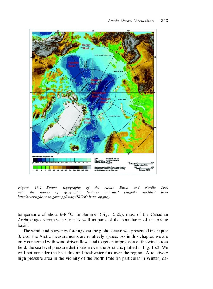
Figure
15.1. Bottom topography of the Arctic Basin and Nordic Seas
with the names of geographic features indicated (slightly modified from
http://www.ngdc.noaa.gov/mgg/image/IBCAO betamap.jpg).
temperature of about 6-8 ◦ C. In Summer (Fig. 15.2b), most of the Canadian
Archipelago becomes ice free as well as parts of the boundaries of the Arctic
basin.
The wind- and buoyancy forcing over the global ocean was presented in chapter
3; over the Arctic measurements are relatively sparse. As in this chapter, we are
only concerned with wind-driven flows and to get an impression of the wind stress
field, the sea level pressure distribution over the Arctic is plotted in Fig. 15.3. We
will not consider the heat flux and freshwater flux over the region. A relatively
high pressure area in the vicinity of the North Pole (in particular in Winter) de-
353
Figure
15.1. Bottom topography of the Arctic Basin and Nordic Seas
with the names of geographic features indicated (slightly modified from
http://www.ngdc.noaa.gov/mgg/image/IBCAO betamap.jpg).
temperature of about 6-8 ◦ C. In Summer (Fig. 15.2b), most of the Canadian
Archipelago becomes ice free as well as parts of the boundaries of the Arctic
basin.
The wind- and buoyancy forcing over the global ocean was presented in chapter
3; over the Arctic measurements are relatively sparse. As in this chapter, we are
only concerned with wind-driven flows and to get an impression of the wind stress
field, the sea level pressure distribution over the Arctic is plotted in Fig. 15.3. We
will not consider the heat flux and freshwater flux over the region. A relatively
high pressure area in the vicinity of the North Pole (in particular in Winter) de-