

topography and, even more, it is smaller than the resolution of the satellite altimetry
data used in this version of the calculation scheme we accept the following schemes
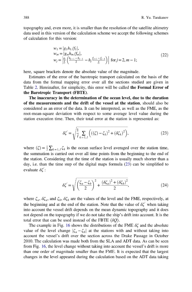
of calculation for this version:
w 1 = g 1 h 1 ̸ f 1
j
j,
w m = g m h m ̸ f m
j
j ,
w j =
g j
f j
h j + 1 − h j − 1
2
− h j
f j + 1 − f j − 1
f j
for j = 2, m − 1;
ð22Þ
here, square brackets denote the absolute value of the magnitude.
Estimates of the error of the barotropic transport calculated on the basis of the
data from the formal mapping error over all the sections studied are given in
Table 2. Hereinafter, for simplicity, this error will be called the Formal Error of
the Barotropic Transport (FBTE).
The inaccuracy in the determination of the ocean level, due to the duration
of the measurements and the drift of the vessel at the station, should also be
considered as an error of the data. It can be interpreted, as well as the FME, as the
root-mean-square deviation with respect to some average level value during the
station execution time. Then, their total error at the station is represented as:
δζ
′ =
ffiffiffiffiffiffiffiffiffiffiffiffiffiffiffiffiffiffiffiffiffiffiffiffiffiffiffiffiffiffiffiffiffiffiffiffiffiffiffiffiffiffiffiffiffiffiffiffiffiffiffiffiffiffiffiffi ffi
1
l
∑
k = 1, l
⟨ζ⟩ − ζ k
ð
Þ
2 + δζ k
ð Þ
2
s
,
ð23Þ
where ⟨ζ⟩ =
1
l ∑ k = 1, l ζ k is the ocean surface level averaged over the station time,
the summation is carried out over all time points from the beginning to the end of
the station. Considering that the time of the station is usually much shorter than a
day, i.e. than the time step of the digital maps formula (23) can be simplified to
evaluate δζ
′ :
δζ
′ =
ffiffiffiffiffiffiffiffiffiffiffiffiffiffiffiffiffiffiffiffiffiffiffiffiffiffiffiffiffiffiffiffiffiffiffiffiffiffiffiffiffiffiffiffiffiffiffiffiffiffiffiffiffiffiffiffiffi
ζ a − ζ b
2
2
+
δζ a
ð Þ
2 + δζ b
ð Þ
2
2
s
,
ð24Þ
where ζ a , δζ a , and ζ b , δζ b are the values of the level and the FME, respectively, at
the beginning and at the end of the station. Note that the value of δζ
′ when taking
into account the vessel drift depends on the mean dynamic topography and it does
not depend on the topography if we do not take the ship’s drift into account. It is the
total error that can be used instead of the FBTE ⟨δQ⟩.
The example in Fig. 16 shows the distributions of the FME δζ and the absolute
value of the level change ζ a − ζ b
j
j at the stations with and without taking into
account the vessel’s drift over the section across the Drake Passage in October
2010. The calculation was made both from the SLA and ADT data. As can be seen
from Fig. 16, the level change without taking into account the vessel’s drift is more
than one order of magnitude smaller than the FME. It is expected that the largest
changes in the level appeared during the calculation based on the ADT data taking
388
R. Yu. Tarakanov
data used in this version of the calculation scheme we accept the following schemes
of calculation for this version:
w 1 = g 1 h 1 ̸ f 1
j
j,
w m = g m h m ̸ f m
j
j ,
w j =
g j
f j
h j + 1 − h j − 1
2
− h j
f j + 1 − f j − 1
f j
for j = 2, m − 1;
ð22Þ
here, square brackets denote the absolute value of the magnitude.
Estimates of the error of the barotropic transport calculated on the basis of the
data from the formal mapping error over all the sections studied are given in
Table 2. Hereinafter, for simplicity, this error will be called the Formal Error of
the Barotropic Transport (FBTE).
The inaccuracy in the determination of the ocean level, due to the duration
of the measurements and the drift of the vessel at the station, should also be
considered as an error of the data. It can be interpreted, as well as the FME, as the
root-mean-square deviation with respect to some average level value during the
station execution time. Then, their total error at the station is represented as:
δζ
′ =
ffiffiffiffiffiffiffiffiffiffiffiffiffiffiffiffiffiffiffiffiffiffiffiffiffiffiffiffiffiffiffiffiffiffiffiffiffiffiffiffiffiffiffiffiffiffiffiffiffiffiffiffiffiffiffiffi ffi
1
l
∑
k = 1, l
⟨ζ⟩ − ζ k
ð
Þ
2 + δζ k
ð Þ
2
s
,
ð23Þ
where ⟨ζ⟩ =
1
l ∑ k = 1, l ζ k is the ocean surface level averaged over the station time,
the summation is carried out over all time points from the beginning to the end of
the station. Considering that the time of the station is usually much shorter than a
day, i.e. than the time step of the digital maps formula (23) can be simplified to
evaluate δζ
′ :
δζ
′ =
ffiffiffiffiffiffiffiffiffiffiffiffiffiffiffiffiffiffiffiffiffiffiffiffiffiffiffiffiffiffiffiffiffiffiffiffiffiffiffiffiffiffiffiffiffiffiffiffiffiffiffiffiffiffiffiffiffi
ζ a − ζ b
2
2
+
δζ a
ð Þ
2 + δζ b
ð Þ
2
2
s
,
ð24Þ
where ζ a , δζ a , and ζ b , δζ b are the values of the level and the FME, respectively, at
the beginning and at the end of the station. Note that the value of δζ
′ when taking
into account the vessel drift depends on the mean dynamic topography and it does
not depend on the topography if we do not take the ship’s drift into account. It is the
total error that can be used instead of the FBTE ⟨δQ⟩.
The example in Fig. 16 shows the distributions of the FME δζ and the absolute
value of the level change ζ a − ζ b
j
j at the stations with and without taking into
account the vessel’s drift over the section across the Drake Passage in October
2010. The calculation was made both from the SLA and ADT data. As can be seen
from Fig. 16, the level change without taking into account the vessel’s drift is more
than one order of magnitude smaller than the FME. It is expected that the largest
changes in the level appeared during the calculation based on the ADT data taking
388
R. Yu. Tarakanov