

356 Nadia Pinardi et al.
fit the needs ofthe high-resolution coastal model ing. This coastal observing system
44N
43N
42N
41N
40N
J9N
J8N
II
J7N
" V
J6N
,' 1 , .11
JSN
34N
a)
33N
32N
JIN
SW
o
5E
10E
44N
4JN
42N
41N
40N
39N
38N
(
37/1
. ~(
36/1
' . \
35N
34/1
33N
b)
32N
31N
sw
o
SE
10E
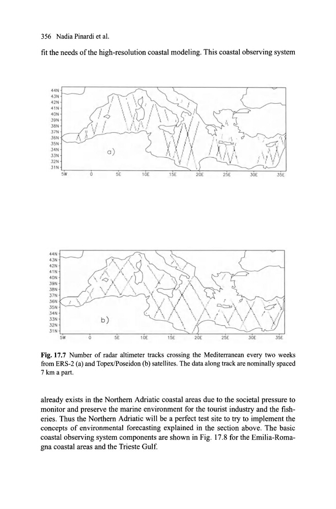
Fig. 17.7 Number of radar altimeter tracks crossing the Mediterranean every two weeks
from ERS-2 (a) and TopexIPoseidon (b) satellites. The data along track are nominally spaced
7 km a part.
already exists in the Northem Adriatic coastal areas due to the societal pressure to
monitor and preserve the marine environment for the tourist industry and the fisheries. Thus the Northem Adriatic will be a perfect test site to try to implement the
concepts of environmental forecasting explained in the section above. The basic
coasta! observing system components are shown in Fig. 17.8 for the EmiIia-Romagna coasta! areas and the Trieste Gu!f.
fit the needs ofthe high-resolution coastal model ing. This coastal observing system
44N
43N
42N
41N
40N
J9N
J8N
II
J7N
" V
J6N
,' 1 , .11
JSN
34N
a)
33N
32N
JIN
SW
o
5E
10E
44N
4JN
42N
41N
40N
39N
38N
(
37/1
. ~(
36/1
' . \
35N
34/1
33N
b)
32N
31N
sw
o
SE
10E
Fig. 17.7 Number of radar altimeter tracks crossing the Mediterranean every two weeks
from ERS-2 (a) and TopexIPoseidon (b) satellites. The data along track are nominally spaced
7 km a part.
already exists in the Northem Adriatic coastal areas due to the societal pressure to
monitor and preserve the marine environment for the tourist industry and the fisheries. Thus the Northem Adriatic will be a perfect test site to try to implement the
concepts of environmental forecasting explained in the section above. The basic
coasta! observing system components are shown in Fig. 17.8 for the EmiIia-Romagna coasta! areas and the Trieste Gu!f.